(Attention, message in inglish pour donner quelques tuyaux à ceux qui voudraient randonner dans les mêmes endroits que nous)
Who: the two of us (1 gal & 1 guy 30-year old hiking enthusiasts).
What: multi-day (2 to 6 days) hiking, about 10mi/day.
Where: in the wilderness of six National Park in Western US.
When: late summer/fall. With the obvious exception of our warm hike in Yosemite NP, the weather conditions were mild/cold (temps generally 30-60°F, i.e. 0-15°C).
Our choice to hike in late August in Denali and late September in Yellowstone prevented us from being eaten alive by insects. I cannot remember being bothered by more than one or two mosquitos in all these weeks!
How: backpacking over two to six days, which means reasonably big packs.
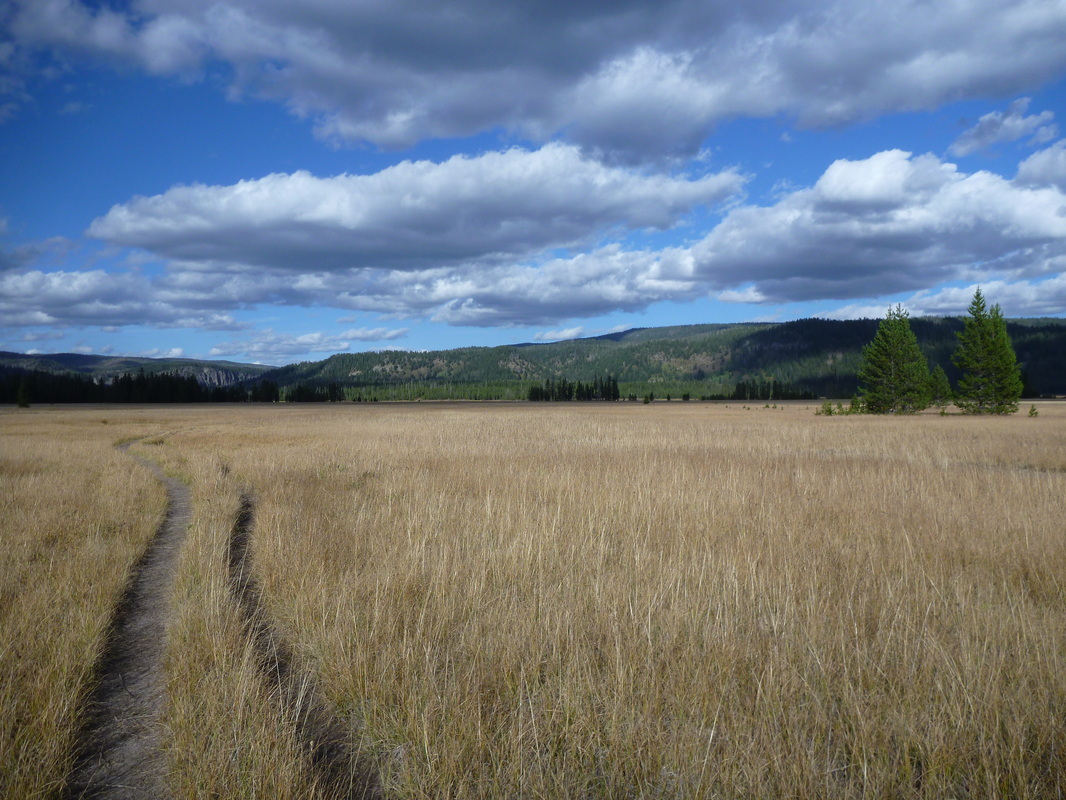
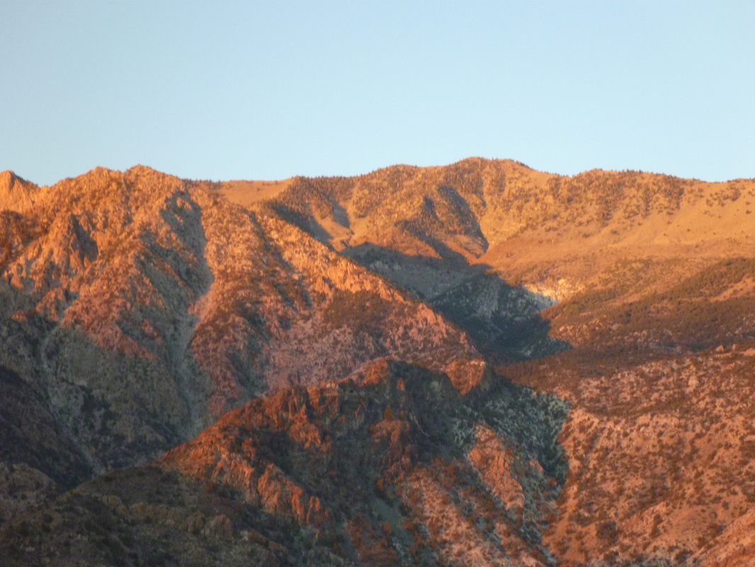
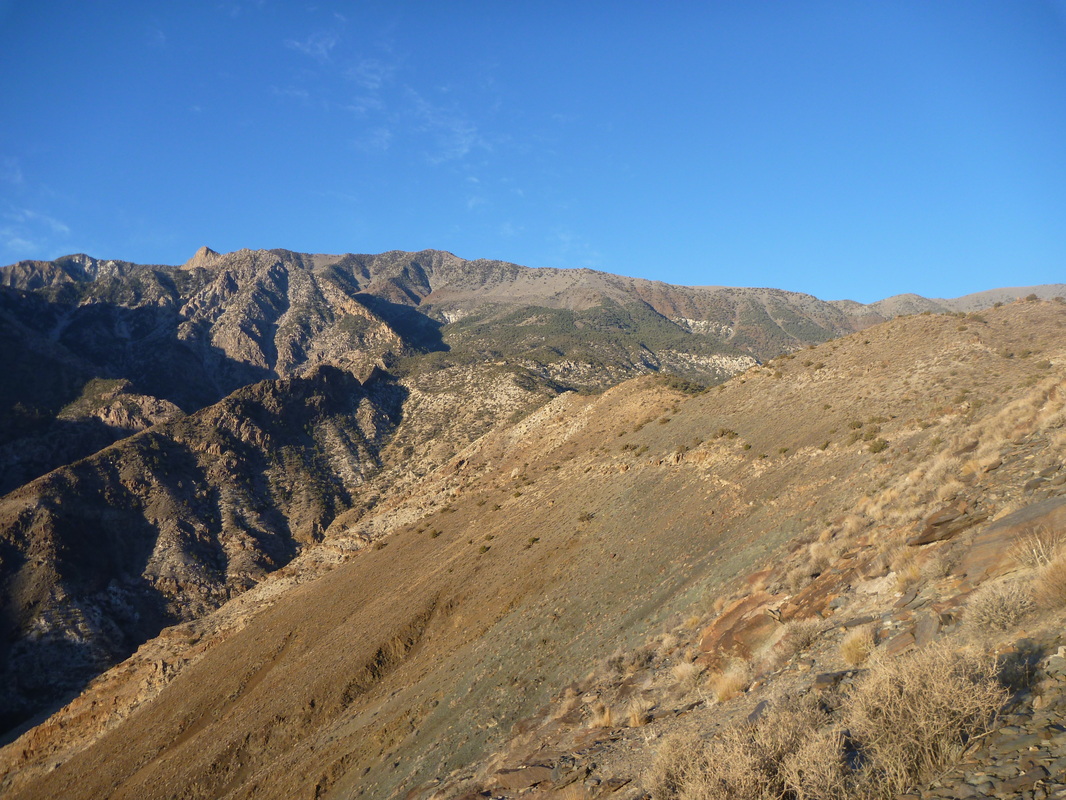
Backcountry trip #1 : Denali NP (August 25 – 31, 2013). 6 days, 56mi, around 7000 ft +/-. Units 06 and 10.
What an introduction to backcountry hiking!
We chose to split this hike in two, in order to explore two different environments. That turned out to be a very good choice: a three-day hike for the two of us required the use of one large bear-proof food containers. We stored one at Teklanika campground while in the backcountry with the other. The shuttle system allowed us to dedicate no more than a few hours to partially dry our stuff, wash our teeth, take clean (not silty !) water and shift from one BPFC to the other.
No problem with the water supply that came from the many silty streams and rivers.
Note that the process of getting the wilderness permit takes time... Lots of time! It took us 3 hours total. It is anyway very instructive and talking with rangers definitely helped to choose which Unit was best for us.
Unit 10 (3 full days): West Branch of Upper Toklat River. Map B-1.
Start/End: Toklat.
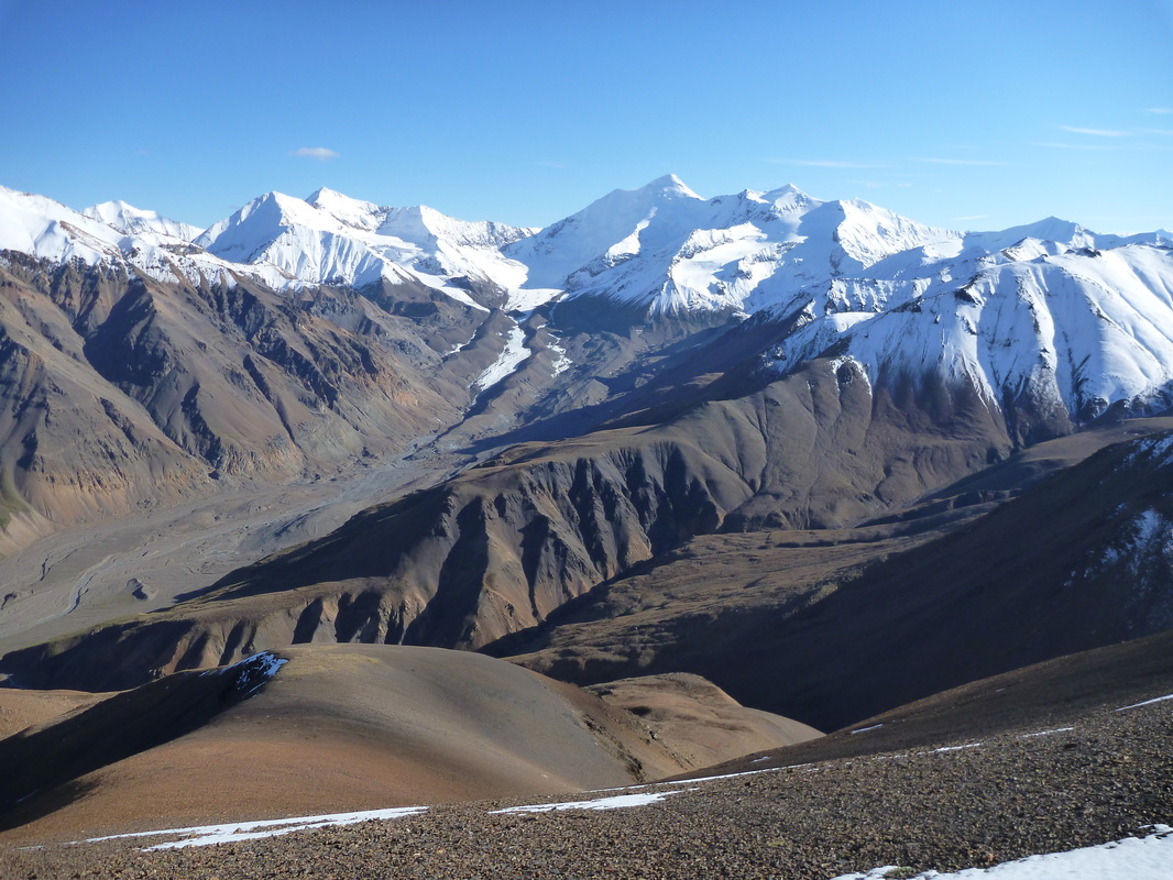
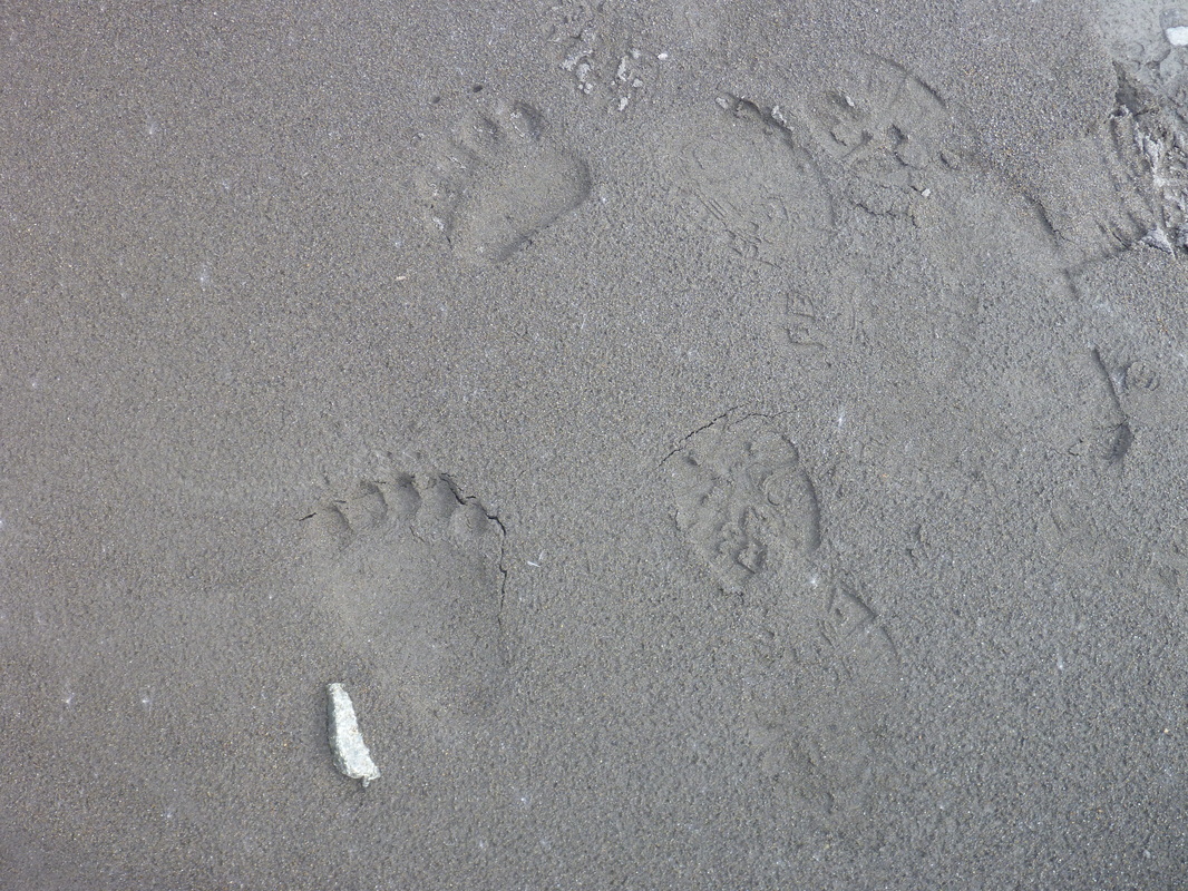
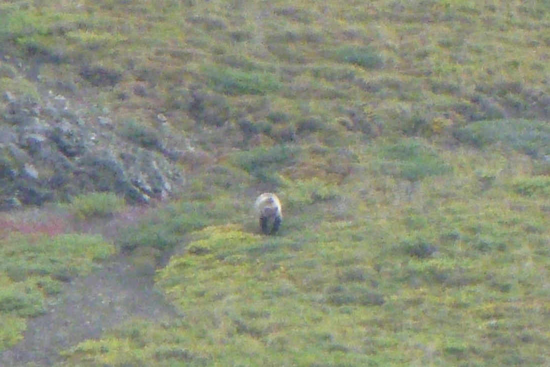
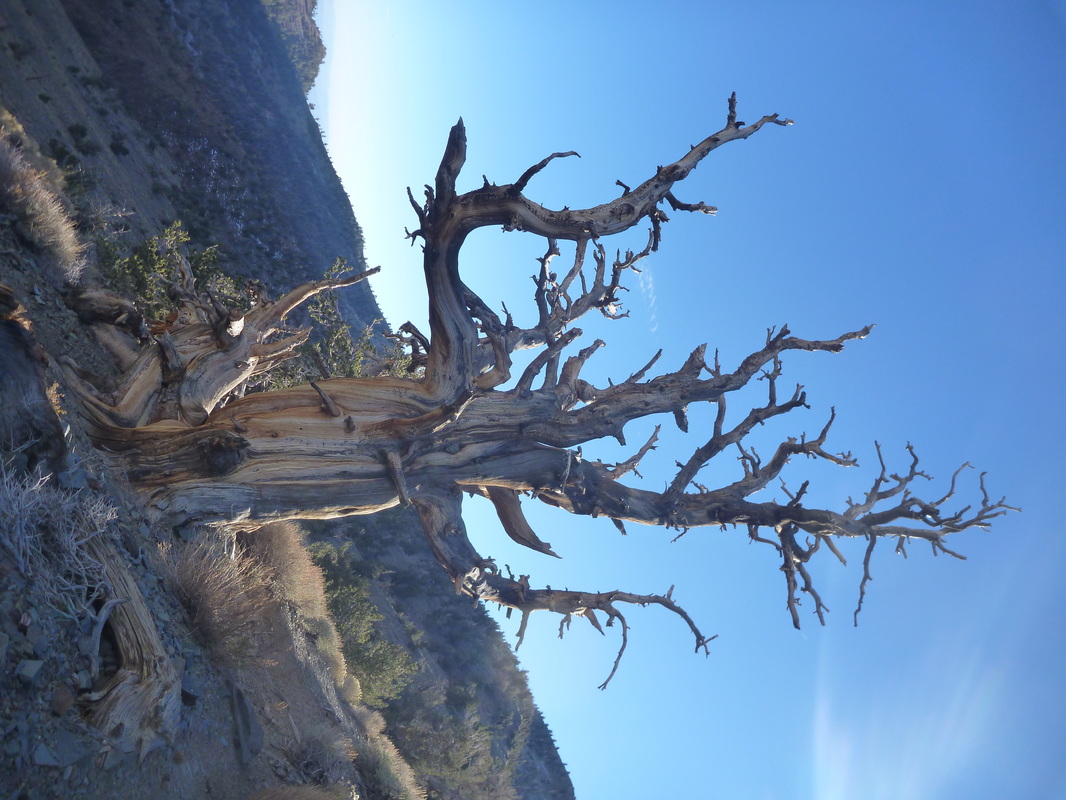
This Unit allows very, very spectacular hiking. It is home to several unnoticing very busy grizzlies; allowing daily encounters. Ptarmigans over 4500ft, peregrine falcon along the crest.
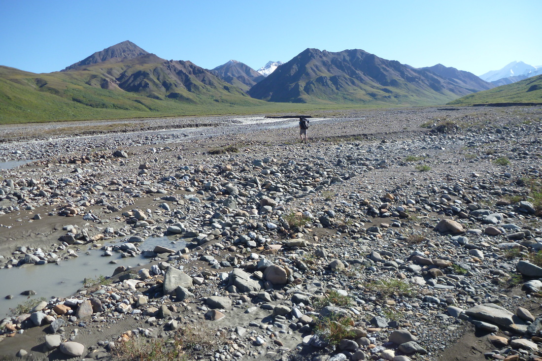
The river is a rather significant crossing. On day 3, we crossed the west fork (square #20), east fork (square #21) and then the whole West Branch (square #17) to get back to our camp. It took us between 2 and 5 painful minutes.
Day 1 (3pm – 6.30pm): Toklat – Base camp (square #9 on map B-1).
We went up the Toklat river on its west, left side. Easy walk along the gravel bars. 5 mi, mostly flat.
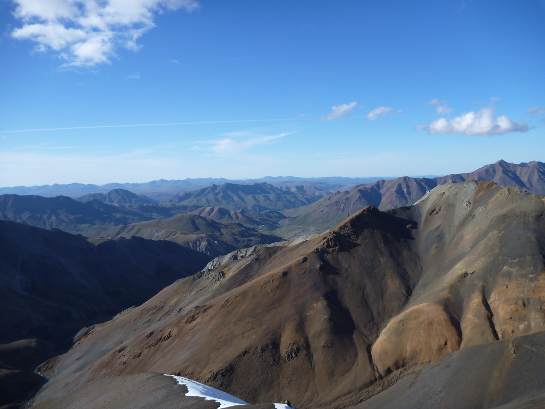
Day 2 (11am – 10pm): Base camp – Glacier at top of West fork of the West Branch (square #36) – unnamed 5800+ ft summit along the crest (that separates Unit 10/Unit 11) and back.
Easy walk up to the impressive glacier, first in gravel bars, then across large boulders. We chose to do a quick climb to the crest, to have a view over Unit 11. Great choice! Sweeping views over 20+ miles to the West. Great views over Mt Denali too. 12 mi, 2700 ft +/-.
Day 3 (11am – 8pm): Base camp – Glacier at top of East fork of the West Branch (square #33) and back. 11 mi, around 1500 ft +/-.
Pretty similar to day 2, maybe less enjoyable according to both of us. A bit less spectacular and longer walk to get to the smaller glacier. Getting close to it was tricky (dangerous?). Still a great day! Below 4000ft is a delightfull stroll in heavy grass.
Day 4 (10am – 1pm): Base camp – Toklat rest stop. 5 mi, mostly flat. Easy walk down the river.
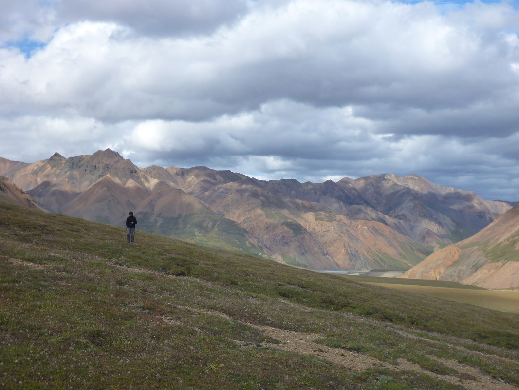
Unit 6 (3 full days): Upper Teklanika River. Maps B-6 and C-6.
The elevation is lower than Unit 10 (around 3000ft). Vegetation is dense is some parts (spruce forest, low brush and wet tundra). Anyway, the Teklanika bar is open and free from brush, allowing "fast" travel.
Start: social trail between Sable Pass and Tattler Creek. End: Igloo Creek campground.
Some grizzly encounters. Few birds. Harlequin duck in the glacial stream.
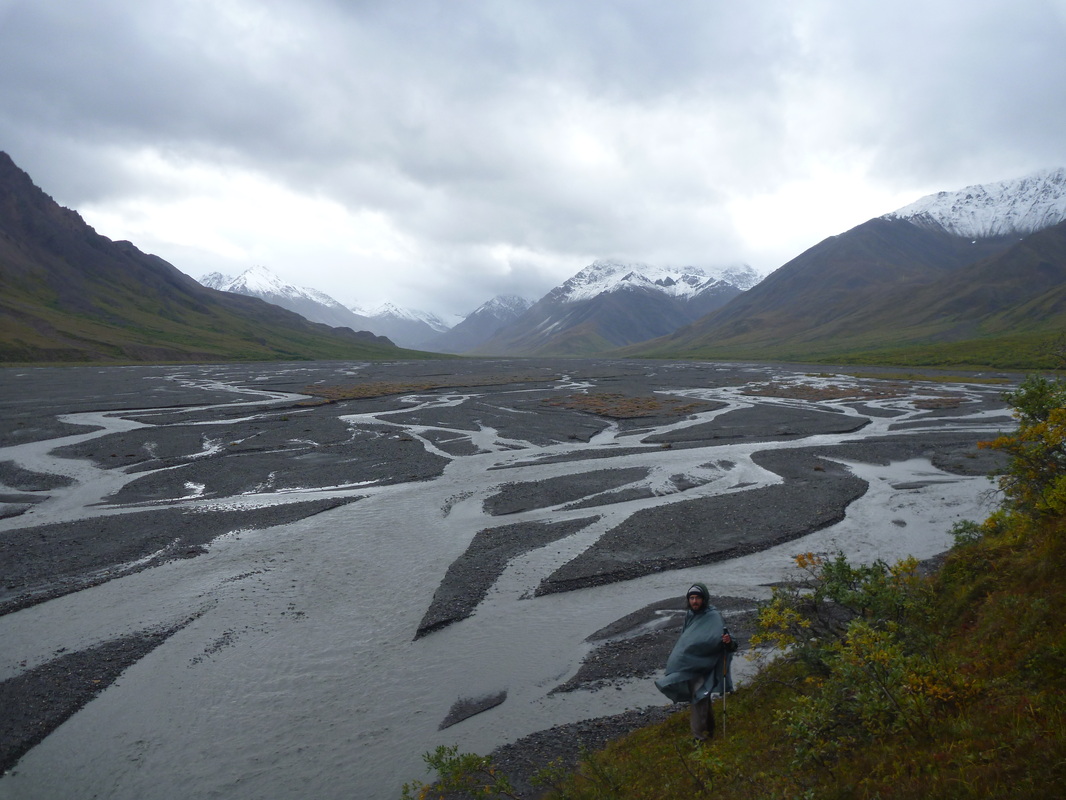
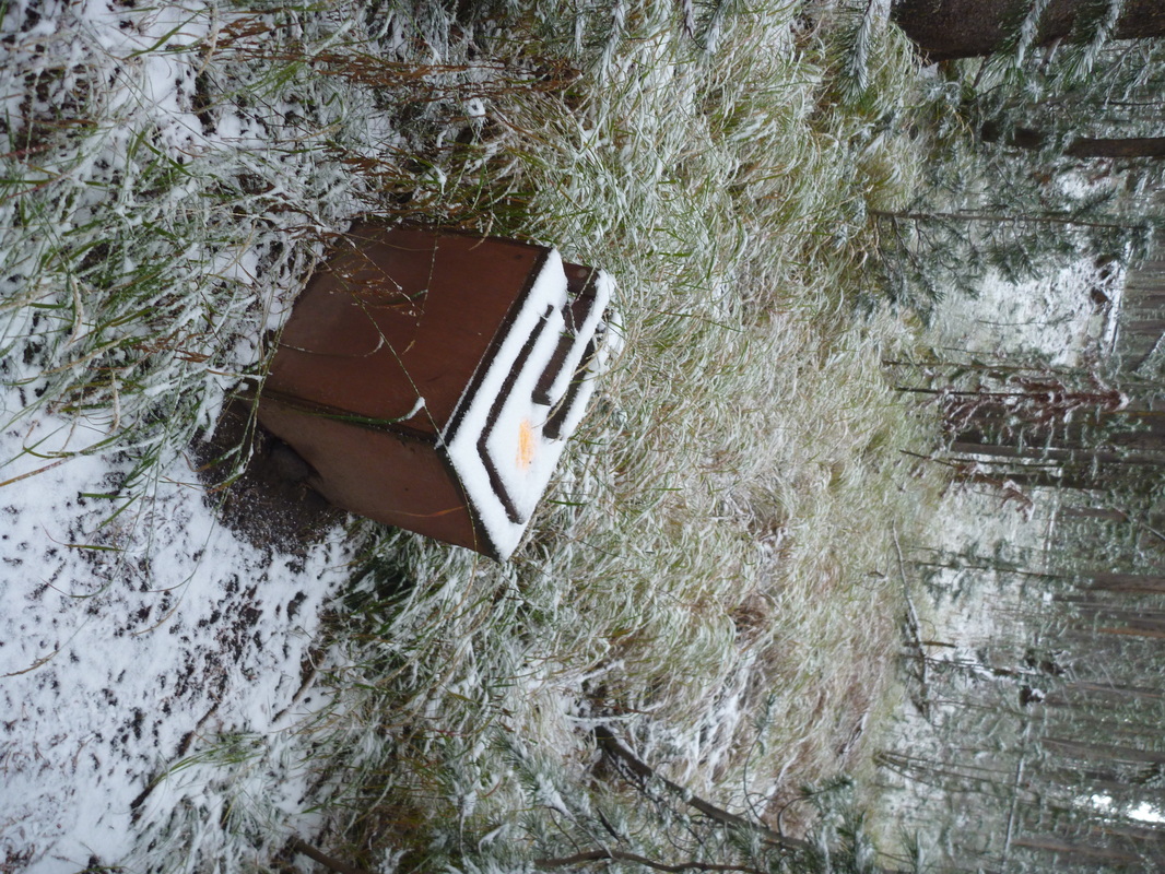
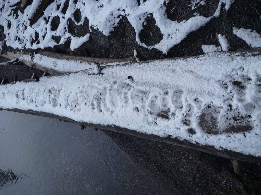
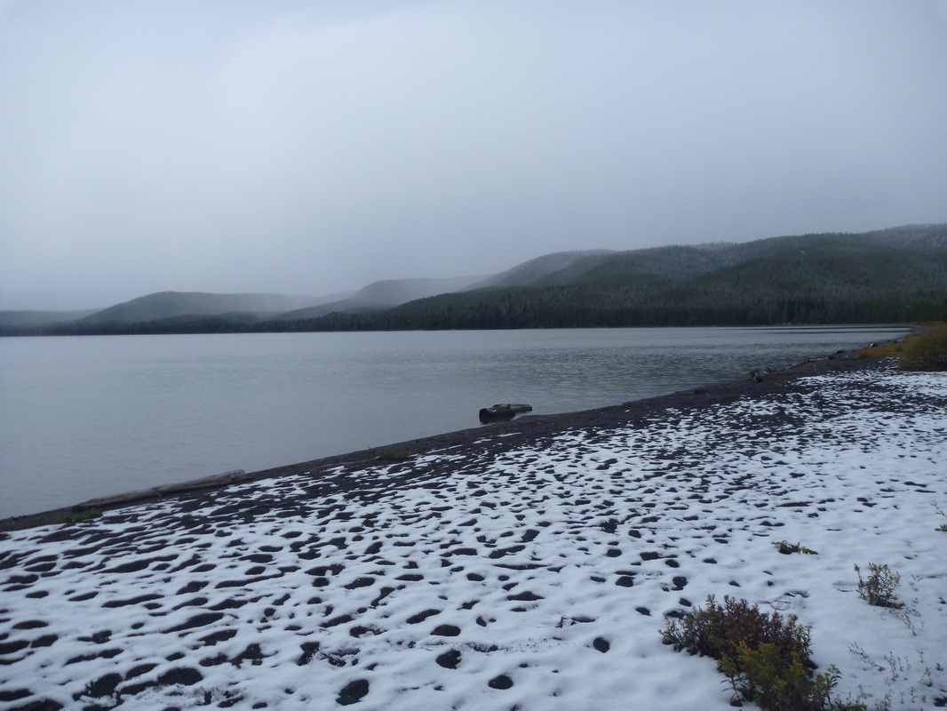
Weather was rainy/snowy, making the river quite impressive. We decided not to cross it. Temps between 30°F/-1°C (on day 4; with snow sticking on the ground) and 50°F/+10°C.
Day 1 (4pm – 8pm): Roadside – Camp (#13 on Map C-6). Reaching the River is a somewhat strenuous, downhill walk across heavy brush and very open sruce forest. Wonderful views along the way anyway. 3 mi.
Day 2 (11am – 8pm): Camp – glacier on top of West fork and back. Very remote walk in wide valleys to the Cirque (#11 on Map B-6). Foul weather made this long walk a bit tiring. Anyway, a great sense of remoteness here and some great views over grizzly bears. 14 mi, 2000 ft +/-.
Day 3 (12.30pm – 5.30pm): Moving the camp downriver a bit (to square #6) at the foot of Cathedral Mnt. Terrible weather (wind and cold rain) all day long. 3 mi.
Day 4 (10.30am – 2pm): Exploring the spruce forests on the slopes of Cathedral Mnts in the snow. Great wilderness walk using compass only. Slow progress and good views over the East. 3 mi.
What an introduction to backcountry hiking!
We chose to split this hike in two, in order to explore two different environments. That turned out to be a very good choice: a three-day hike for the two of us required the use of one large bear-proof food containers. We stored one at Teklanika campground while in the backcountry with the other. The shuttle system allowed us to dedicate no more than a few hours to partially dry our stuff, wash our teeth, take clean (not silty !) water and shift from one BPFC to the other.
No problem with the water supply that came from the many silty streams and rivers.
Note that the process of getting the wilderness permit takes time... Lots of time! It took us 3 hours total. It is anyway very instructive and talking with rangers definitely helped to choose which Unit was best for us.
Unit 10 (3 full days): West Branch of Upper Toklat River. Map B-1.
Start/End: Toklat.
This Unit allows very, very spectacular hiking. It is home to several unnoticing very busy grizzlies; allowing daily encounters. Ptarmigans over 4500ft, peregrine falcon along the crest.
The river is a rather significant crossing. On day 3, we crossed the west fork (square #20), east fork (square #21) and then the whole West Branch (square #17) to get back to our camp. It took us between 2 and 5 painful minutes.
Day 1 (3pm – 6.30pm): Toklat – Base camp (square #9 on map B-1).
We went up the Toklat river on its west, left side. Easy walk along the gravel bars. 5 mi, mostly flat.
Day 2 (11am – 10pm): Base camp – Glacier at top of West fork of the West Branch (square #36) – unnamed 5800+ ft summit along the crest (that separates Unit 10/Unit 11) and back.
Easy walk up to the impressive glacier, first in gravel bars, then across large boulders. We chose to do a quick climb to the crest, to have a view over Unit 11. Great choice! Sweeping views over 20+ miles to the West. Great views over Mt Denali too. 12 mi, 2700 ft +/-.
Day 3 (11am – 8pm): Base camp – Glacier at top of East fork of the West Branch (square #33) and back. 11 mi, around 1500 ft +/-.
Pretty similar to day 2, maybe less enjoyable according to both of us. A bit less spectacular and longer walk to get to the smaller glacier. Getting close to it was tricky (dangerous?). Still a great day! Below 4000ft is a delightfull stroll in heavy grass.
Day 4 (10am – 1pm): Base camp – Toklat rest stop. 5 mi, mostly flat. Easy walk down the river.
Unit 6 (3 full days): Upper Teklanika River. Maps B-6 and C-6.
The elevation is lower than Unit 10 (around 3000ft). Vegetation is dense is some parts (spruce forest, low brush and wet tundra). Anyway, the Teklanika bar is open and free from brush, allowing "fast" travel.
Start: social trail between Sable Pass and Tattler Creek. End: Igloo Creek campground.
Some grizzly encounters. Few birds. Harlequin duck in the glacial stream.
Weather was rainy/snowy, making the river quite impressive. We decided not to cross it. Temps between 30°F/-1°C (on day 4; with snow sticking on the ground) and 50°F/+10°C.
Day 1 (4pm – 8pm): Roadside – Camp (#13 on Map C-6). Reaching the River is a somewhat strenuous, downhill walk across heavy brush and very open sruce forest. Wonderful views along the way anyway. 3 mi.
Day 2 (11am – 8pm): Camp – glacier on top of West fork and back. Very remote walk in wide valleys to the Cirque (#11 on Map B-6). Foul weather made this long walk a bit tiring. Anyway, a great sense of remoteness here and some great views over grizzly bears. 14 mi, 2000 ft +/-.
Day 3 (12.30pm – 5.30pm): Moving the camp downriver a bit (to square #6) at the foot of Cathedral Mnt. Terrible weather (wind and cold rain) all day long. 3 mi.
Day 4 (10.30am – 2pm): Exploring the spruce forests on the slopes of Cathedral Mnts in the snow. Great wilderness walk using compass only. Slow progress and good views over the East. 3 mi.
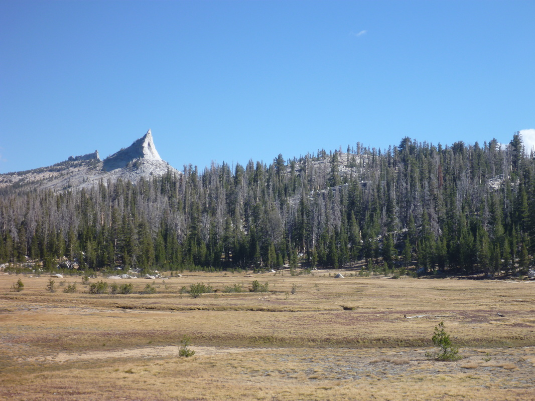
Backcountry trip #2: Yosemite NP (Sept. 12 – 16, 2013). 4.5 days, 46 mi, around 11000 ft +/-. Little Yosemite Valley.
Perfect weather (temps 50-80°F, i.e. 10-28°C; blue skies), albeit low visibility on Day 1 due to the wildfire in the west part of the Park.
We chose a 45-mi loop in typical Yosemite landscapes, with two summits along the way (Clouds Rest and Half Dome).
This one was by far the less remote backcountry experience we had, with at least some people met every day. Very enjoyable anyway. Getting the permit can take a lot of time, depending on the amount of people waiting at the Wilderness Center (most of these guys want to dayhike Half Dome). Bear-proof food containers are required and can be rented.
Because we could not refill our stove in a gas station in CA (legislation requires a special type of gas pump that does not allow direct filling of stove containers), we simply did not take it. It meant no coffee or hot meal, which was perfectly fine given the weather; and 2lb less in our packs was welcome! On the other hand, water supply was rather scarce and we often had to carry 4-8lb of water.
Start/End: Happy Isles.
Day 1 (4 pm – 7.15pm): Happy Isles – Little Yosemite Valley campground. Crowded trail (!!) but good views over waterfalls. With our 40-45lb backpacks, this first energetic hike up to the Valley was pretty slow. 4mi, 2000 ft +.
Day 2 (9am – 6.30pm): Little Yosemite Valley campground – Cathedral Fork valley (4183000N x 2870000 E).
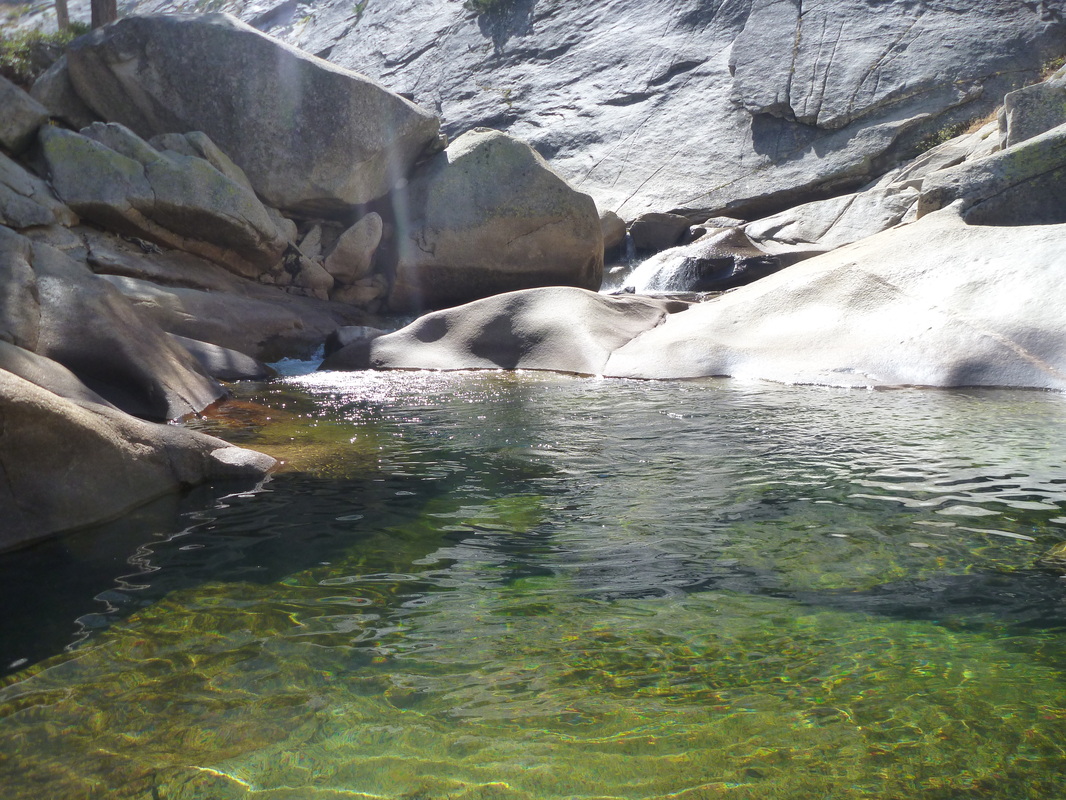
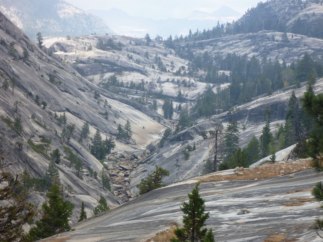
Walked up the Merced River; then up Cathedral Fork. Typical Yosemite landscape. Cold bath in the Merced River to cool down from the 80°F temps. 10 mi, 2600 ft +, 1000 ft -.
Day 3 (7.20am – 5pm): Cathedral Fork valley – Clouds Rest.
Walked up to Sunrise campground (toilets!) and lovely Sunrise Lakes, then up to the shoulder ¼ mi north-east of Clouds Rest (visibly often-used area to camp). Delightful early start. 10 mi, 2300 ft +, 1400 ft -.
Day 4 (5.40am – 6.45pm): Clouds Rest – Sunrise Creek.
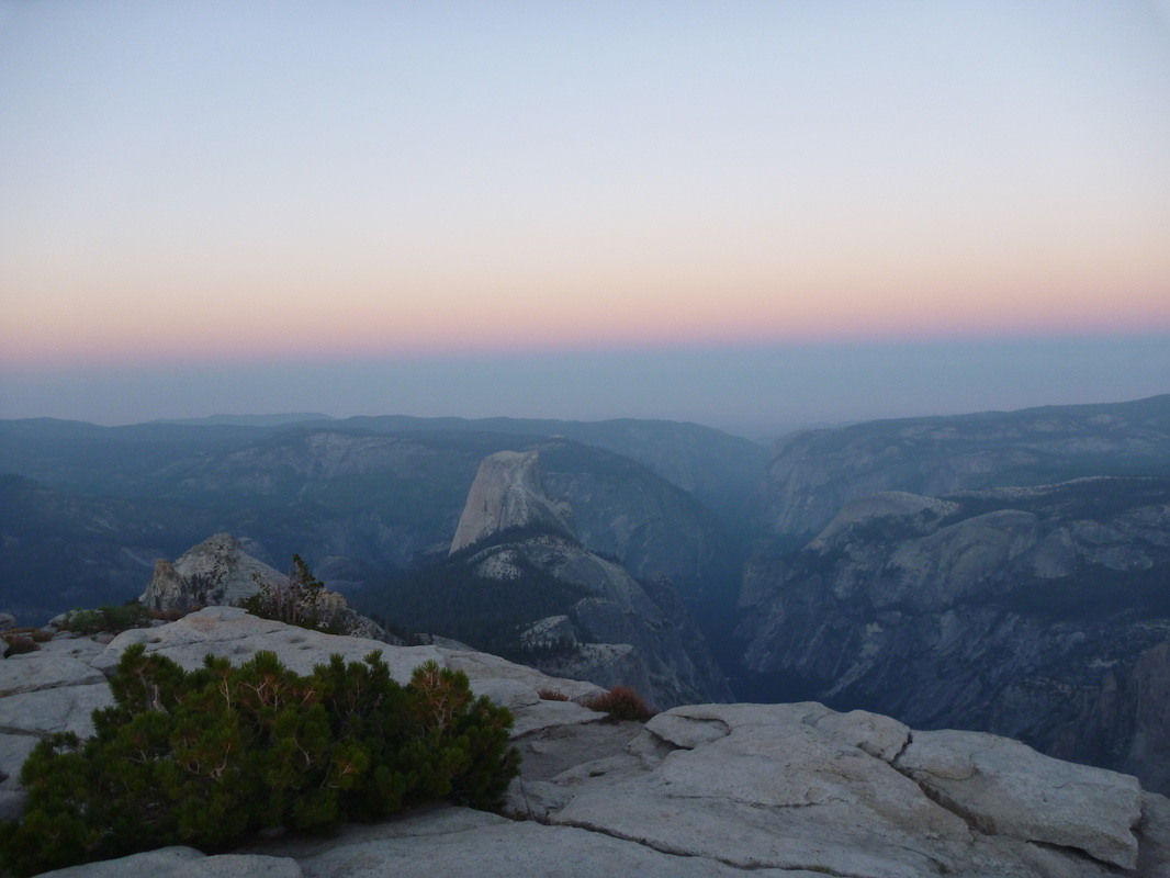
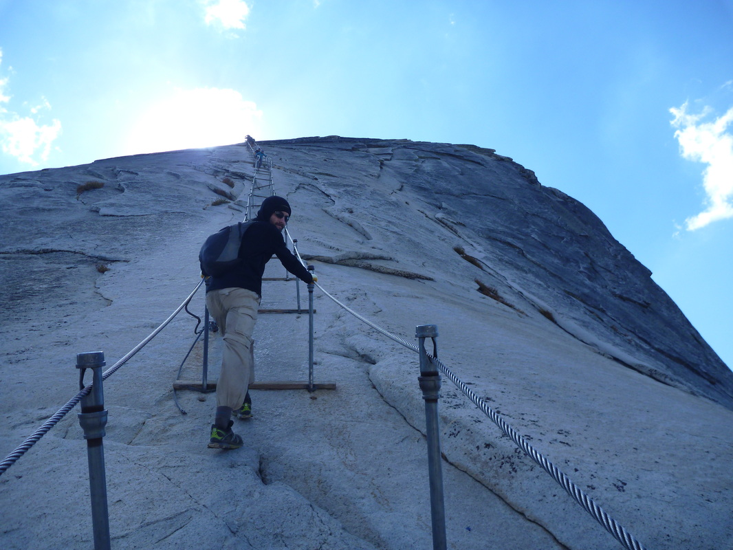
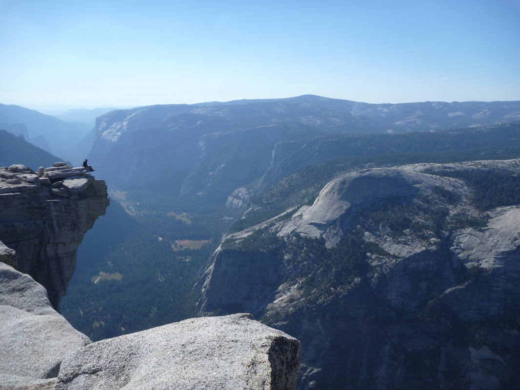
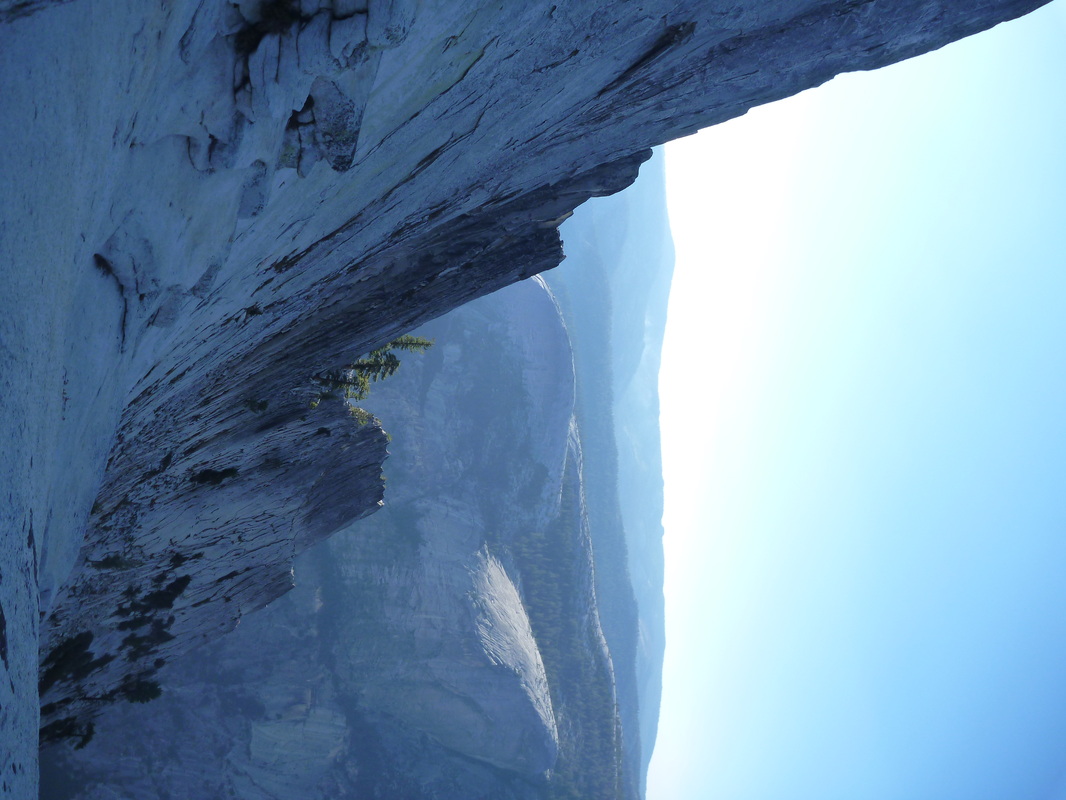
Summited Clouds Rest (9928 ft) before sunset. Wonderful, colorful views over the whole Park, then long walk down to Sunrise Creek, where we established the camp around noon. Climbed up neighboring Half Dome (8836 ft) in the afternoon. Note that the hike up is in the shadow of the Dome, hence we did not suffer from heat and sun. You absolutely need adequate shoes (not worn out!) to climb up Half Dome. The last section is VERY slippery and steep. Depending on your level of comfort with heights, you might feel miserable with even moderately adherent shoes. 11 mi, 3100 ft +, 5300 ft -.
Day 5 (7am – 11am): Sunrise Creek – Happy Isles. Downhill walk along the John Muir Trail back to the trailhead. Longer but less steep. 8 mi, 3300 ft -.
Perfect weather (temps 50-80°F, i.e. 10-28°C; blue skies), albeit low visibility on Day 1 due to the wildfire in the west part of the Park.
We chose a 45-mi loop in typical Yosemite landscapes, with two summits along the way (Clouds Rest and Half Dome).
This one was by far the less remote backcountry experience we had, with at least some people met every day. Very enjoyable anyway. Getting the permit can take a lot of time, depending on the amount of people waiting at the Wilderness Center (most of these guys want to dayhike Half Dome). Bear-proof food containers are required and can be rented.
Because we could not refill our stove in a gas station in CA (legislation requires a special type of gas pump that does not allow direct filling of stove containers), we simply did not take it. It meant no coffee or hot meal, which was perfectly fine given the weather; and 2lb less in our packs was welcome! On the other hand, water supply was rather scarce and we often had to carry 4-8lb of water.
Start/End: Happy Isles.
Day 1 (4 pm – 7.15pm): Happy Isles – Little Yosemite Valley campground. Crowded trail (!!) but good views over waterfalls. With our 40-45lb backpacks, this first energetic hike up to the Valley was pretty slow. 4mi, 2000 ft +.
Day 2 (9am – 6.30pm): Little Yosemite Valley campground – Cathedral Fork valley (4183000N x 2870000 E).
Walked up the Merced River; then up Cathedral Fork. Typical Yosemite landscape. Cold bath in the Merced River to cool down from the 80°F temps. 10 mi, 2600 ft +, 1000 ft -.
Day 3 (7.20am – 5pm): Cathedral Fork valley – Clouds Rest.
Walked up to Sunrise campground (toilets!) and lovely Sunrise Lakes, then up to the shoulder ¼ mi north-east of Clouds Rest (visibly often-used area to camp). Delightful early start. 10 mi, 2300 ft +, 1400 ft -.
Day 4 (5.40am – 6.45pm): Clouds Rest – Sunrise Creek.
Summited Clouds Rest (9928 ft) before sunset. Wonderful, colorful views over the whole Park, then long walk down to Sunrise Creek, where we established the camp around noon. Climbed up neighboring Half Dome (8836 ft) in the afternoon. Note that the hike up is in the shadow of the Dome, hence we did not suffer from heat and sun. You absolutely need adequate shoes (not worn out!) to climb up Half Dome. The last section is VERY slippery and steep. Depending on your level of comfort with heights, you might feel miserable with even moderately adherent shoes. 11 mi, 3100 ft +, 5300 ft -.
Day 5 (7am – 11am): Sunrise Creek – Happy Isles. Downhill walk along the John Muir Trail back to the trailhead. Longer but less steep. 8 mi, 3300 ft -.
Backcountry trip #3: Yellowstone NP (Sept. 21 – 26, 2013). 6 days, 69 mi, around 3000 ft +/-. Bechler River Trail and Shoshone Lake.
Changing weather. Two sunny mild days (temps 50-65°F, i.e. 10-18°C; clear skies), then, rain/snow with 30ish temps. Two lasts days where freezing (temps 25-35°C, i.e. -4/+2°C) with wintry mix/snow showers.
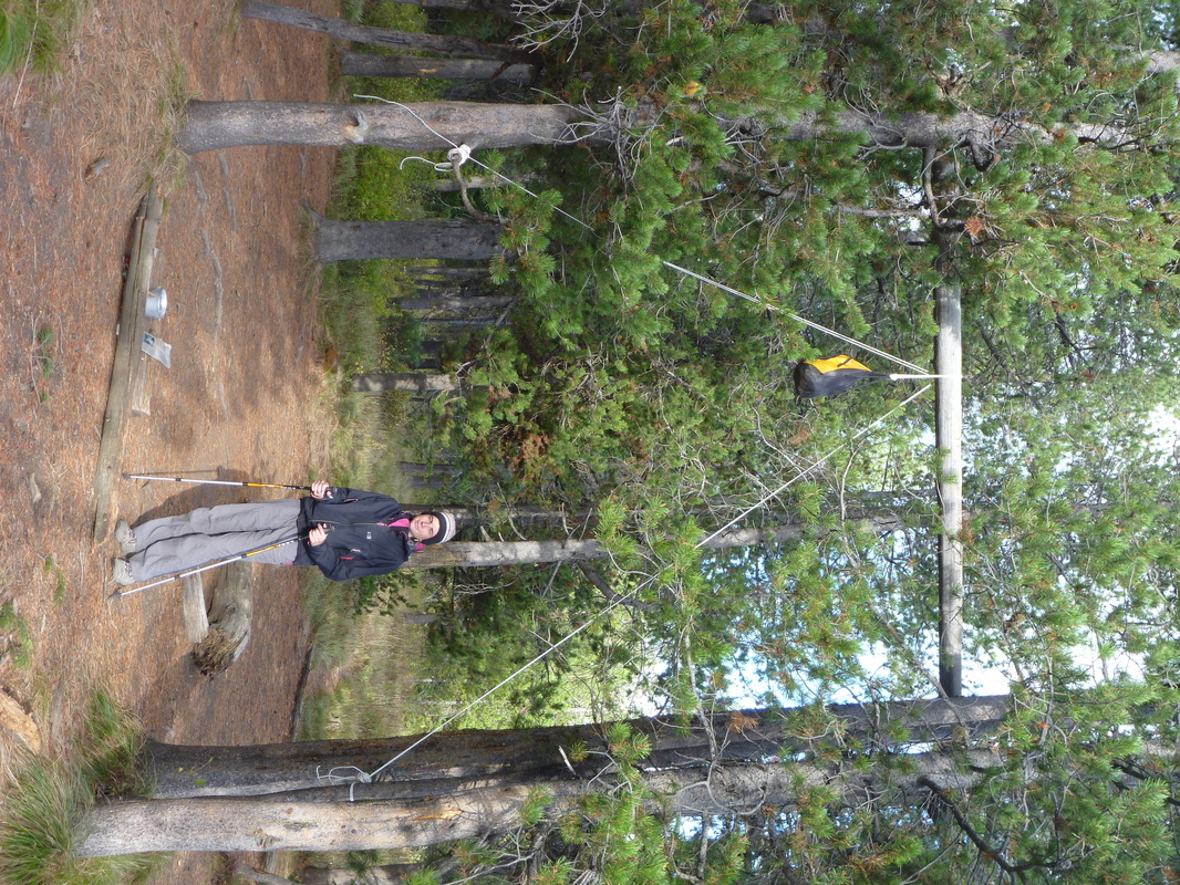
WONDERFUL hike. Pretty remote; with no more than a couple of people seen every day. Perfect timing, as insects got wiped out by cold weather. We only had 1-2 inches of snow on the last two days. Permit process is pretty straightforward. No food containers here, but you need to hang your food on poles. Rope can be purchased at the gas station at Grant Village.
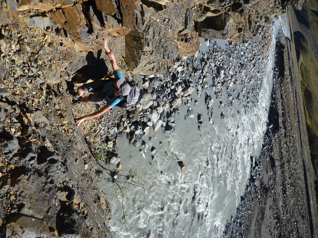
Be aware that the Bechler River is a major crossing... twice, and each way! You have to carefully choose where you want to cross. We think bare foot crossing (like we did, following the advice given by the ranger) was a terrible idea. The first crossing is pretty straightforward, but the second is tricky. We had water up to the belt and current is quite strong.
Start: Lone Star / End: DeLacy Creek.
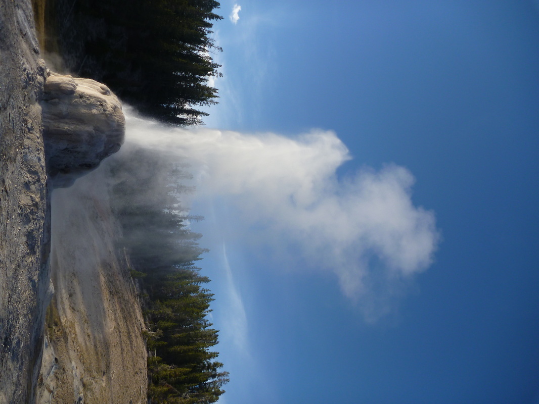
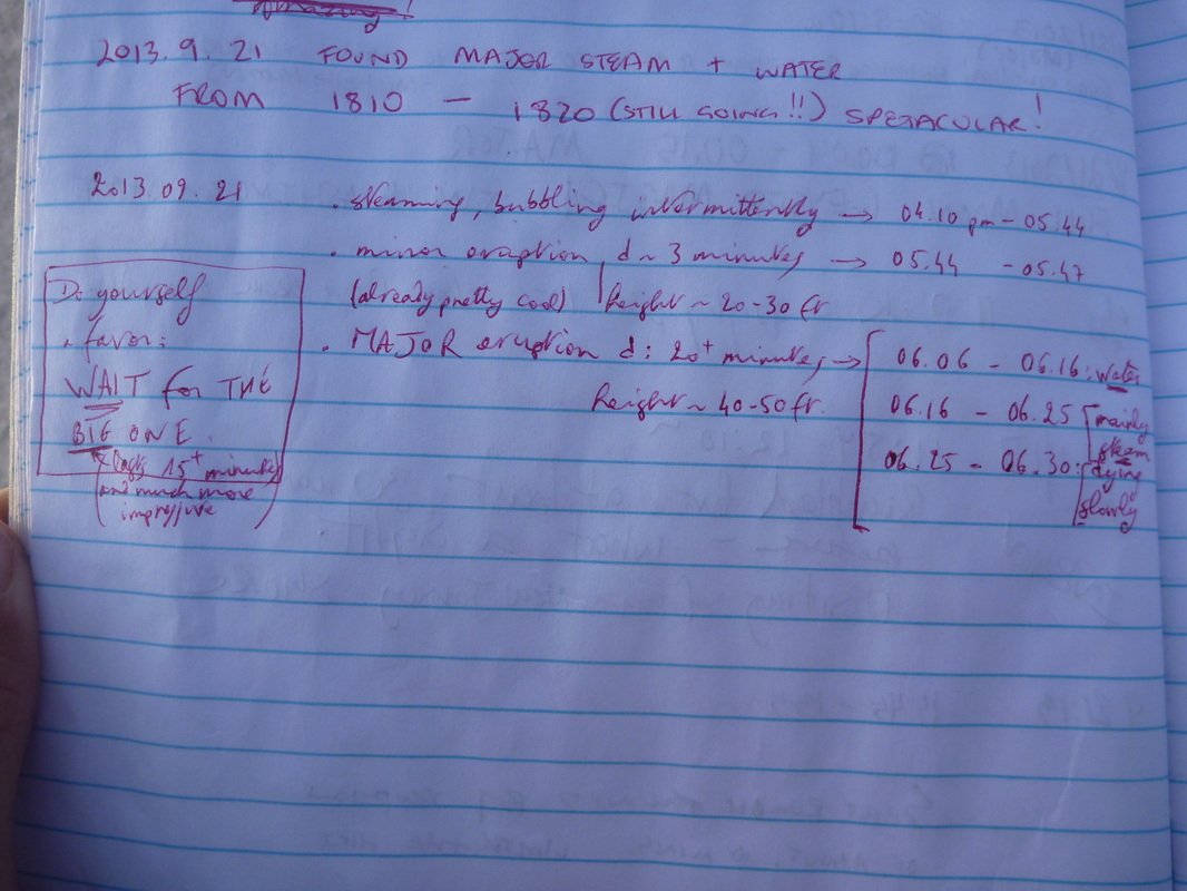
Day 1 (4 pm – 10.15 pm): Lone Star parking lot - 9D4. Wonderful first day. Lone Star is a very impressive geyser. It is very regular and you just have to wait to witness boiling water propelled 50ft up in the air. Important: do not leave after a minor eruption (lasting only a few minutes, 20/30ft)! Wait for a major one (lasts about 20 minutes). We had to wait about 2 hours at the Lone Star for the major eruption. We then had to walk in the dark, which I would not recommend because of the presence of black bears. 9.5 mi, 1000 ft +.
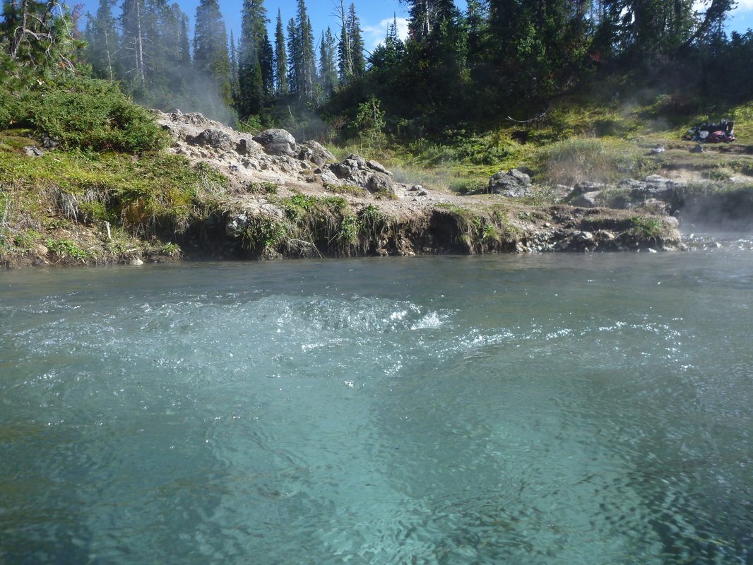
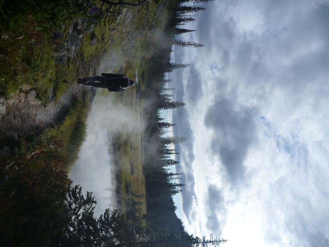
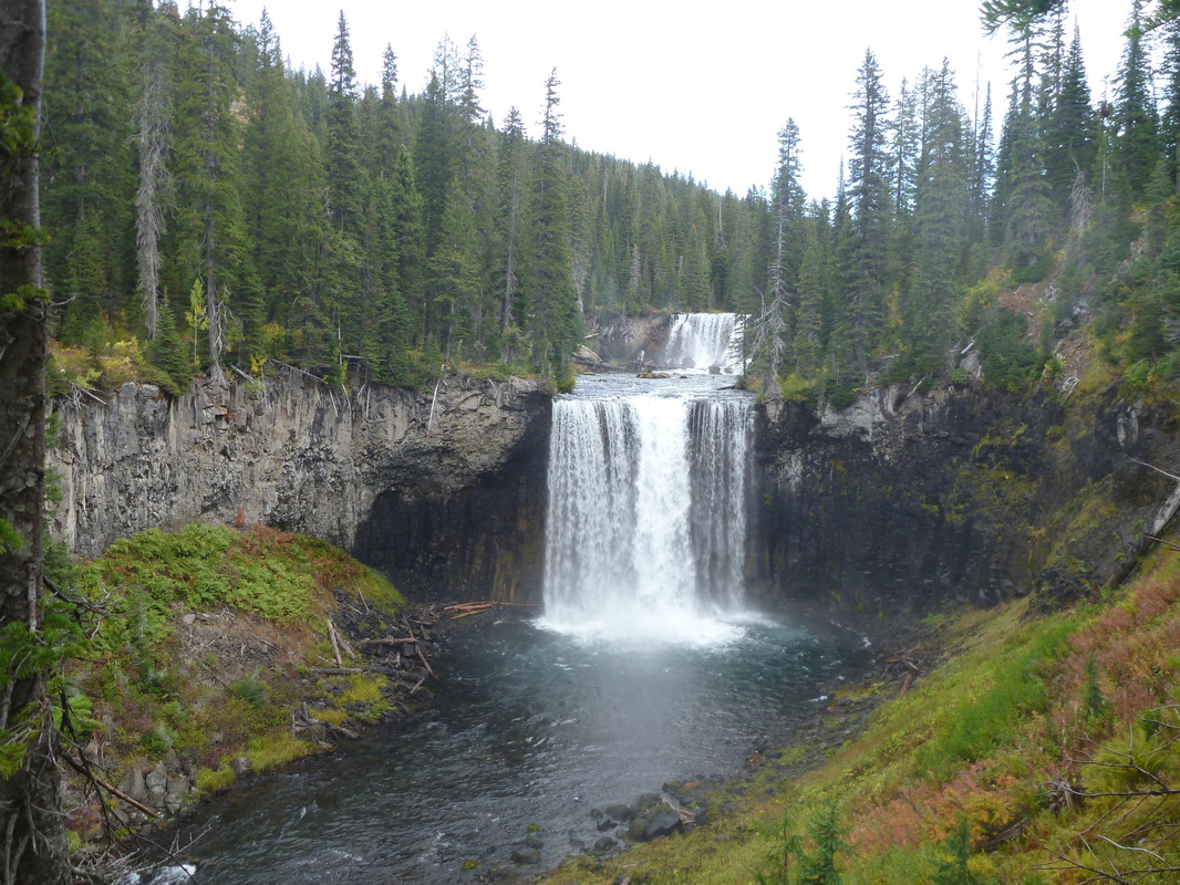
Day 2 (11 am – 9 pm): 9D4 - 9B2. Wonderful hike across what only Yellowstone can offer: thermal pools, fumeroles etc. We walked along the Ferris Fork to get to unforgettable Mr Bubble, about 1/2 mi from the main trail. Do not miss it!! We bathed too long to get to 9B4 before sunset. The two crossings of the Bechler River took us some extra time. Second nightly hike. Pretty bad idea: the river is very noisy and vegetation is dense along the trail. 12 mi, 2000 ft -.
Day 3 (8 am – 6 pm): 9D4 - 9B2. In the morning, we established our camp at 9B2. We then treated ourselves with a delightful stroll across the Bechler meadow (a loop to 9C1, 9B1 and back). Landscape is much more open than the rest of the Bechler River Trail. Grand Teton is visible. Fording the Bechler at 9B2 is pretty deep but almost no current, the one at 9C1 is easy. 9 mi, 300 ft -.
Day 4 (8 am - 6.15 pm): 9B2 - 9D3. Frost adds to the amazing scenery. We start our hike back. Two crossings of the River, and a long bath in MrBubble, again! Right before getting to 9D3, we soaked our feet in the wet meadow. Bye bye dry feet... Weather got colder and wetter with some wintry mix in the evening. 14 mi, 2300 ft+.
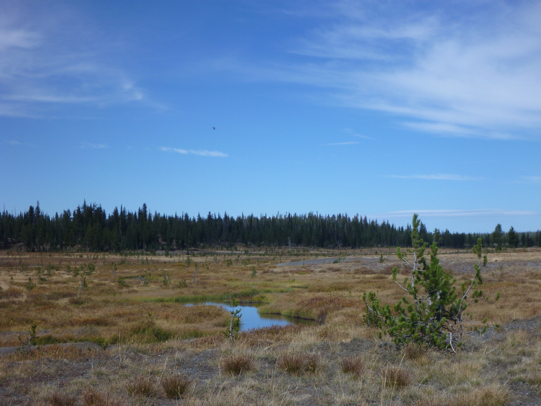
Day 5 (9 am - 4 pm): 9D3 - 8M1 (Bechler River Trail down to 8G1, then South Shore Shoshone Lake Trail). Suprise! Pretty heavy snow is falling as we open the tent around 7am. Snow kept falling all day long, from light wet snow to heavy showers. Winter has arrived! We did not come across anyone that day. The fumeroles and thermal pools on the west tip of the Lake were amazing. Do not miss it too! ... and under the snow, it was unforgettable. The next mile (with footbridges) was very wet. Very cold, wet feet! Landscape along Shoshone Lake is very different from the rest of this hike, more open (and less exciting maybe). 14 mi, 200 ft +/800 ft -.
Day 6 (9.30 am - 3.15 pm): 8M1 - De Lacy Creek trailhead. Somewhat monotonous walk along the Lake shore. Snow showers created a lovely changing scenery. Lowest temp in the morning (25°F!). Hitchhiking to the car was quick and straightforward. 10 mi, almost flat.
Changing weather. Two sunny mild days (temps 50-65°F, i.e. 10-18°C; clear skies), then, rain/snow with 30ish temps. Two lasts days where freezing (temps 25-35°C, i.e. -4/+2°C) with wintry mix/snow showers.
WONDERFUL hike. Pretty remote; with no more than a couple of people seen every day. Perfect timing, as insects got wiped out by cold weather. We only had 1-2 inches of snow on the last two days. Permit process is pretty straightforward. No food containers here, but you need to hang your food on poles. Rope can be purchased at the gas station at Grant Village.
Be aware that the Bechler River is a major crossing... twice, and each way! You have to carefully choose where you want to cross. We think bare foot crossing (like we did, following the advice given by the ranger) was a terrible idea. The first crossing is pretty straightforward, but the second is tricky. We had water up to the belt and current is quite strong.
Start: Lone Star / End: DeLacy Creek.
Day 1 (4 pm – 10.15 pm): Lone Star parking lot - 9D4. Wonderful first day. Lone Star is a very impressive geyser. It is very regular and you just have to wait to witness boiling water propelled 50ft up in the air. Important: do not leave after a minor eruption (lasting only a few minutes, 20/30ft)! Wait for a major one (lasts about 20 minutes). We had to wait about 2 hours at the Lone Star for the major eruption. We then had to walk in the dark, which I would not recommend because of the presence of black bears. 9.5 mi, 1000 ft +.
Day 2 (11 am – 9 pm): 9D4 - 9B2. Wonderful hike across what only Yellowstone can offer: thermal pools, fumeroles etc. We walked along the Ferris Fork to get to unforgettable Mr Bubble, about 1/2 mi from the main trail. Do not miss it!! We bathed too long to get to 9B4 before sunset. The two crossings of the Bechler River took us some extra time. Second nightly hike. Pretty bad idea: the river is very noisy and vegetation is dense along the trail. 12 mi, 2000 ft -.
Day 3 (8 am – 6 pm): 9D4 - 9B2. In the morning, we established our camp at 9B2. We then treated ourselves with a delightful stroll across the Bechler meadow (a loop to 9C1, 9B1 and back). Landscape is much more open than the rest of the Bechler River Trail. Grand Teton is visible. Fording the Bechler at 9B2 is pretty deep but almost no current, the one at 9C1 is easy. 9 mi, 300 ft -.
Day 4 (8 am - 6.15 pm): 9B2 - 9D3. Frost adds to the amazing scenery. We start our hike back. Two crossings of the River, and a long bath in MrBubble, again! Right before getting to 9D3, we soaked our feet in the wet meadow. Bye bye dry feet... Weather got colder and wetter with some wintry mix in the evening. 14 mi, 2300 ft+.
Day 5 (9 am - 4 pm): 9D3 - 8M1 (Bechler River Trail down to 8G1, then South Shore Shoshone Lake Trail). Suprise! Pretty heavy snow is falling as we open the tent around 7am. Snow kept falling all day long, from light wet snow to heavy showers. Winter has arrived! We did not come across anyone that day. The fumeroles and thermal pools on the west tip of the Lake were amazing. Do not miss it too! ... and under the snow, it was unforgettable. The next mile (with footbridges) was very wet. Very cold, wet feet! Landscape along Shoshone Lake is very different from the rest of this hike, more open (and less exciting maybe). 14 mi, 200 ft +/800 ft -.
Day 6 (9.30 am - 3.15 pm): 8M1 - De Lacy Creek trailhead. Somewhat monotonous walk along the Lake shore. Snow showers created a lovely changing scenery. Lowest temp in the morning (25°F!). Hitchhiking to the car was quick and straightforward. 10 mi, almost flat.
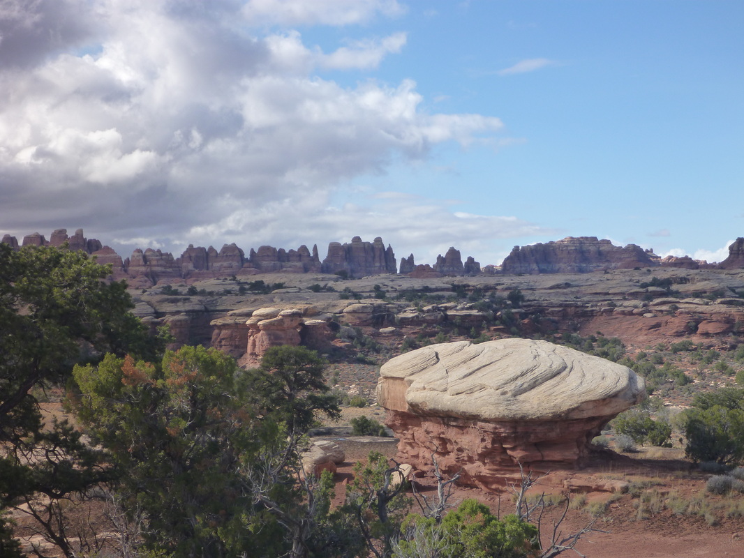
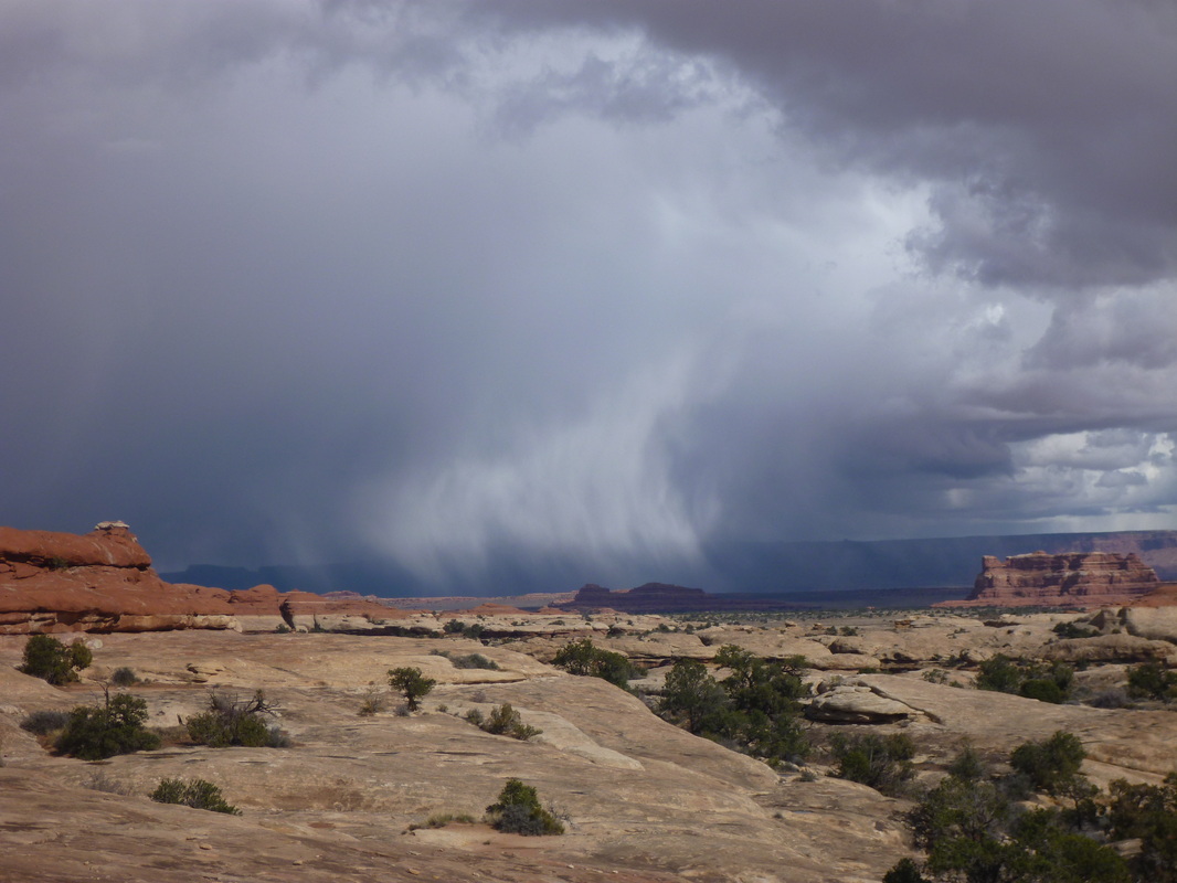
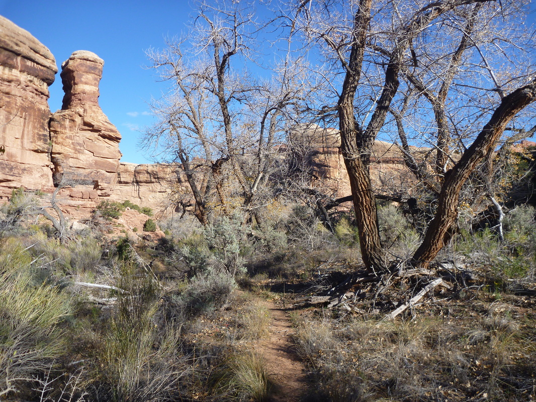
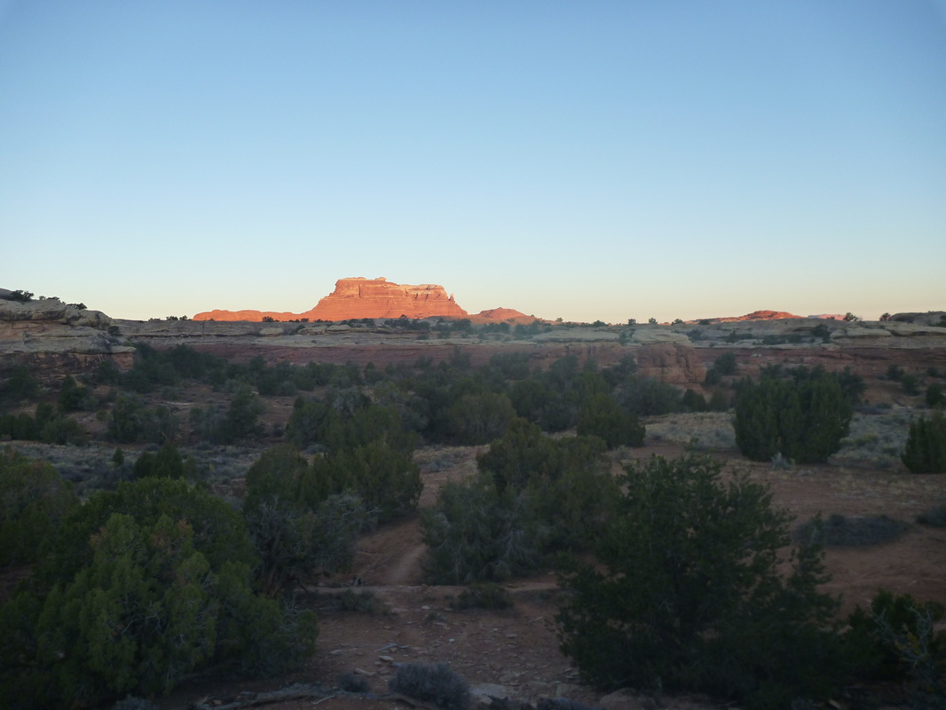
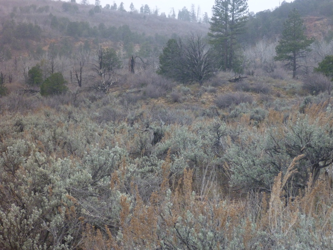
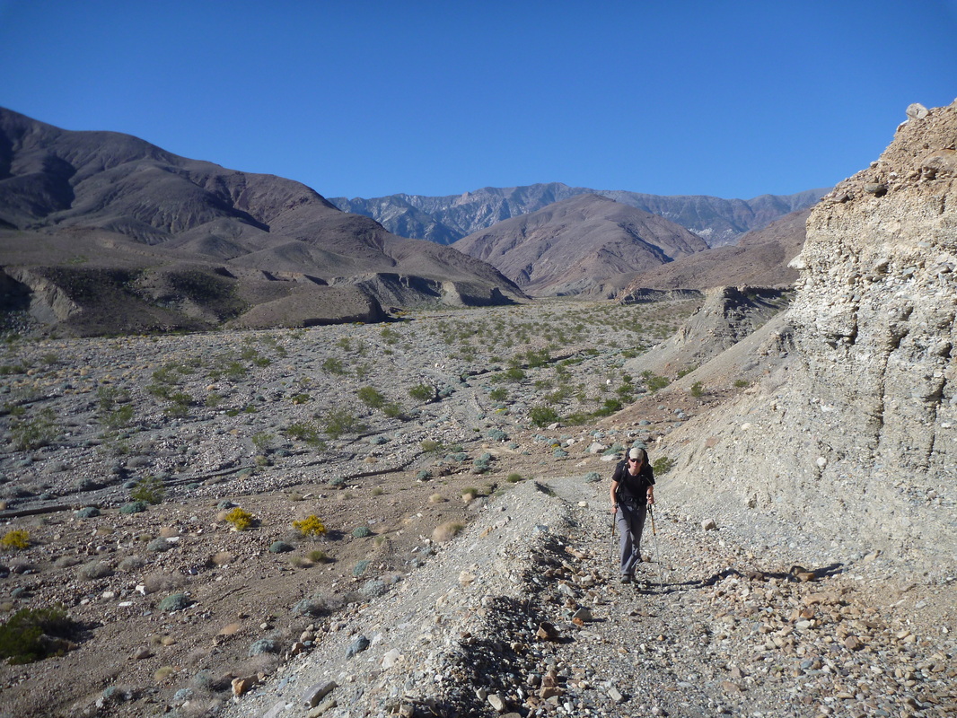
Backcountry trip #4: Canyonlands NP (Oct. 30 – Nov. 1st, 2013). 2.5 days, 25 mi, pretty flat overall. Elephant, Squaw and Lost Canyons.
Lovely hike across typical Canyonlands landscape. We came across a couple of hikers everyday. Weather was very good. Few showers on Day 1, then blue skies. Temps below freezing at night, in the 50s during the day. Permit is fast to get. No food containers needed, but you can rent for free heavy-duty bags that are bugproof at the ranger station! Following the rangers advice, we walked using the unprecise free map provided by the park, paths are mainly well marked.
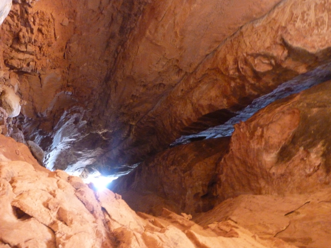
Some scrambling is required on many parts. A heavy backpack makes some part a bit tricky. There is one (pretty impressive) ladder to climb in the Lost Canyon Loop (LC1 to SQ1).
Wildlife was VERY scarce there.
Start/end: Squaw Flat campground.
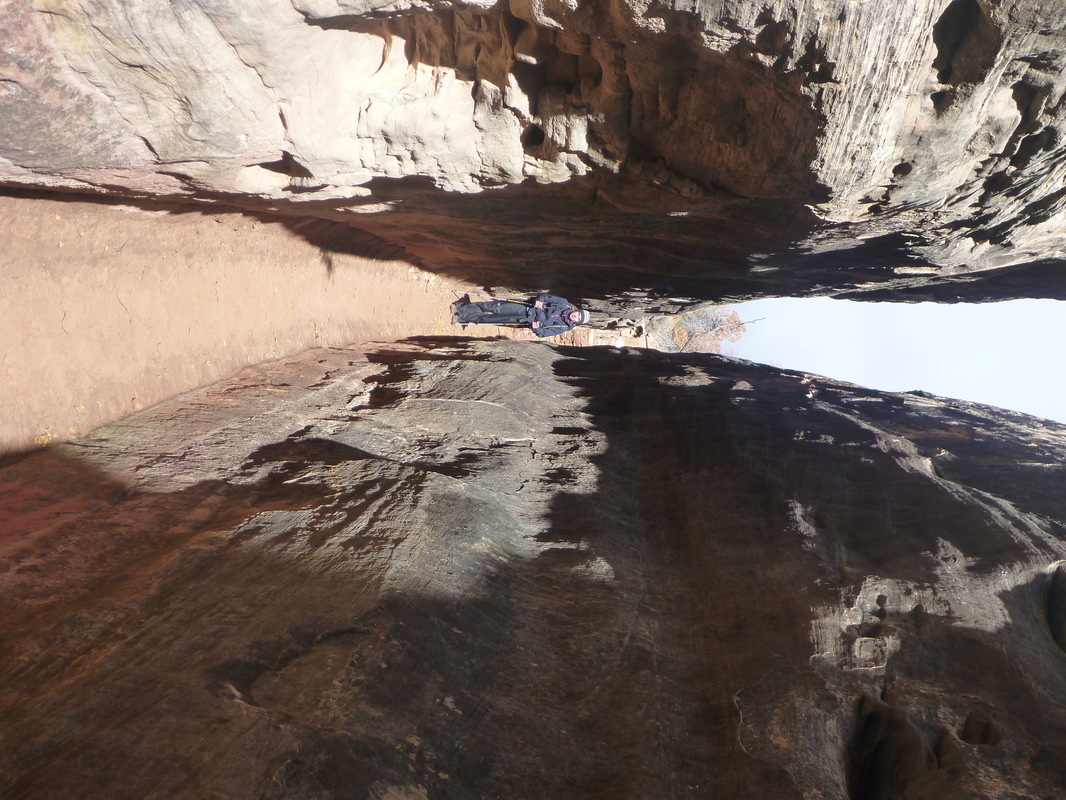
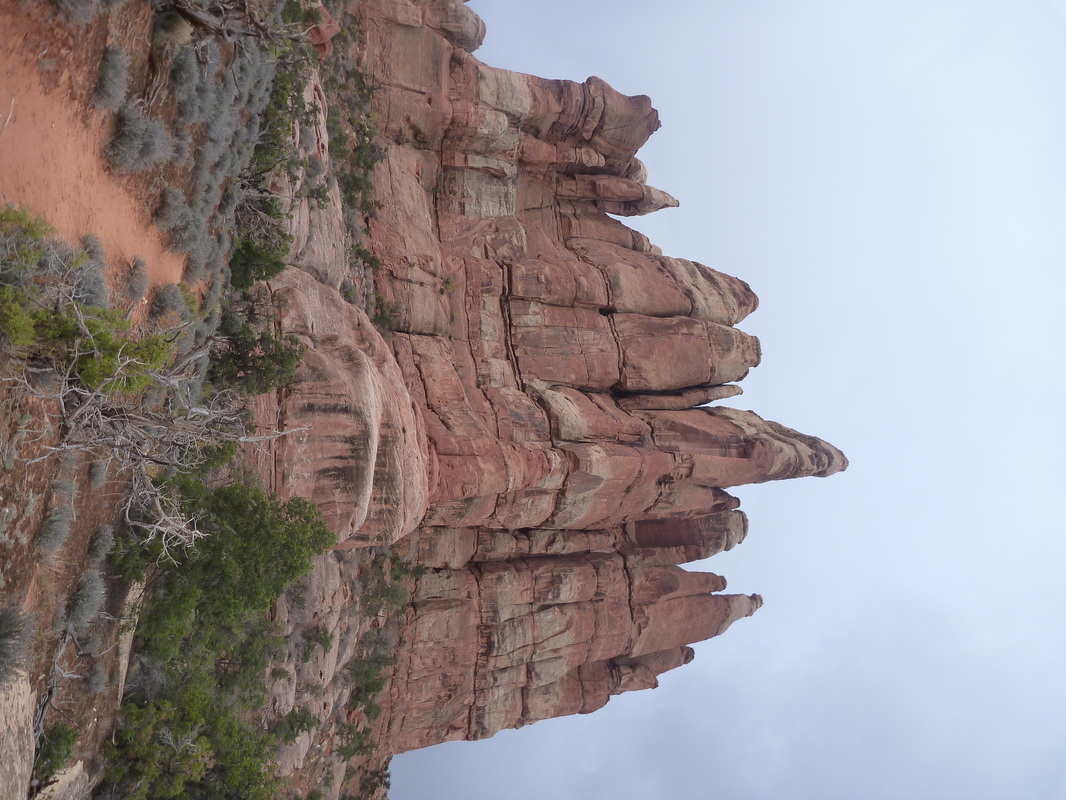
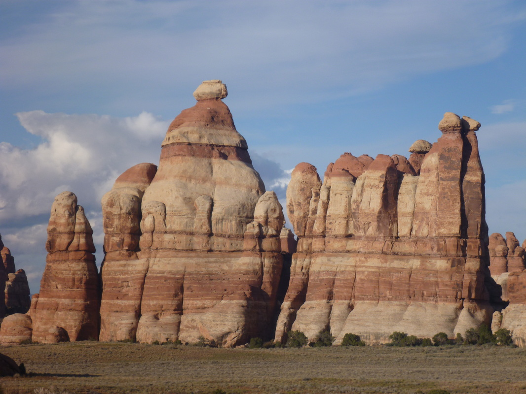
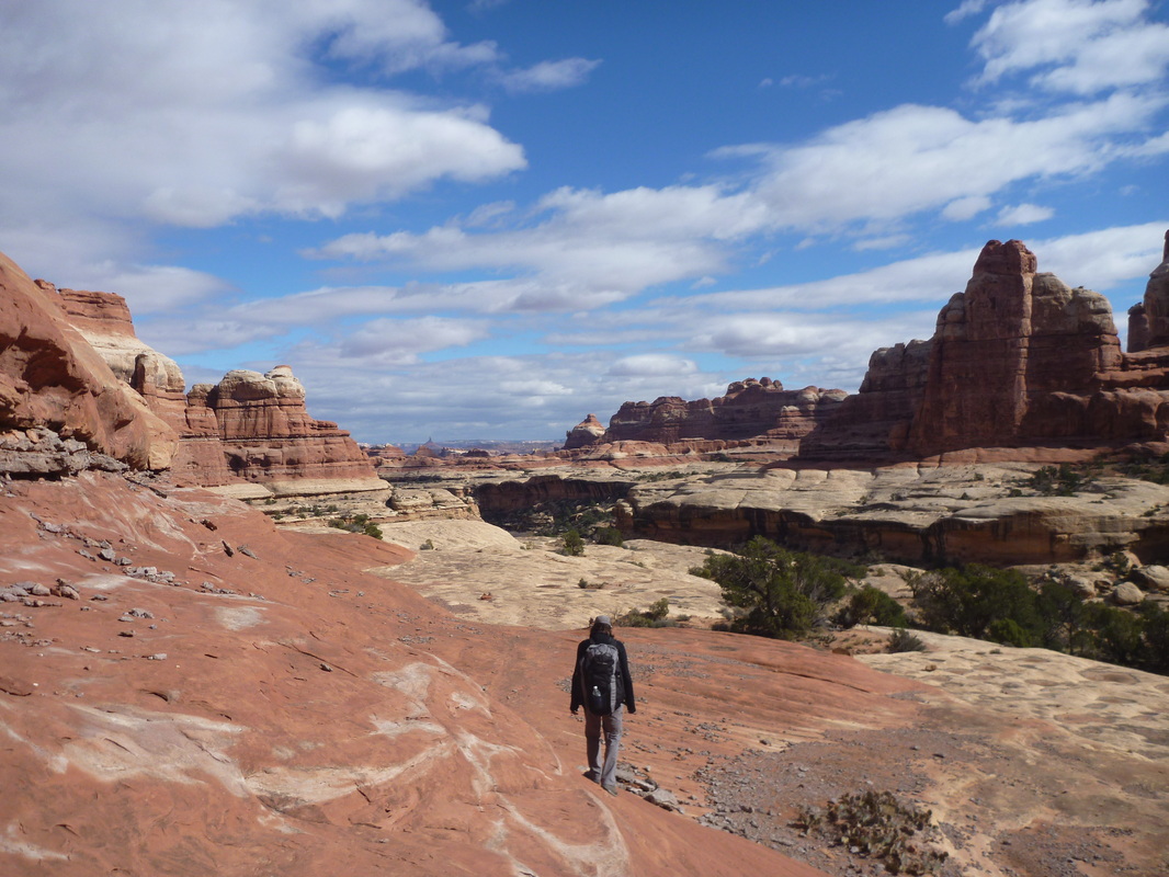
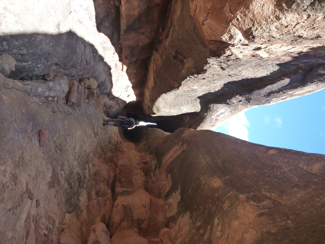
Day 1 (11am - 6pm) Squaw Flat - EC1 - CP1 - CP2- Joint Trail and back - EC2 : Wonderful diversity of landscapes over a short distance. Joint Trail is very spectacular. Chesler Park has open views. 10 mi.
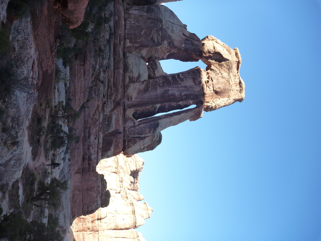
Day 2 (8am - 6pm) EC2 - side walk to Druid Arch and back - SQ2 - LC1 - SQ1: Pretty long day across three canyons. Druid Arch is an impressive at the top of Elephant Canyon. The trail up to the lookout is a bit steep near the end! Lost Canyon is interesting because it has much more vegetation than the others. 13.5 mi.
Day 3 (7.30am - 9am) SQ 1 - Squaw Flat campground: Short walk back to the parking lot. Nice viewsduring sunrise! 1.5 mi.
Lovely hike across typical Canyonlands landscape. We came across a couple of hikers everyday. Weather was very good. Few showers on Day 1, then blue skies. Temps below freezing at night, in the 50s during the day. Permit is fast to get. No food containers needed, but you can rent for free heavy-duty bags that are bugproof at the ranger station! Following the rangers advice, we walked using the unprecise free map provided by the park, paths are mainly well marked.
Some scrambling is required on many parts. A heavy backpack makes some part a bit tricky. There is one (pretty impressive) ladder to climb in the Lost Canyon Loop (LC1 to SQ1).
Wildlife was VERY scarce there.
Start/end: Squaw Flat campground.
Day 1 (11am - 6pm) Squaw Flat - EC1 - CP1 - CP2- Joint Trail and back - EC2 : Wonderful diversity of landscapes over a short distance. Joint Trail is very spectacular. Chesler Park has open views. 10 mi.
Day 2 (8am - 6pm) EC2 - side walk to Druid Arch and back - SQ2 - LC1 - SQ1: Pretty long day across three canyons. Druid Arch is an impressive at the top of Elephant Canyon. The trail up to the lookout is a bit steep near the end! Lost Canyon is interesting because it has much more vegetation than the others. 13.5 mi.
Day 3 (7.30am - 9am) SQ 1 - Squaw Flat campground: Short walk back to the parking lot. Nice viewsduring sunrise! 1.5 mi.
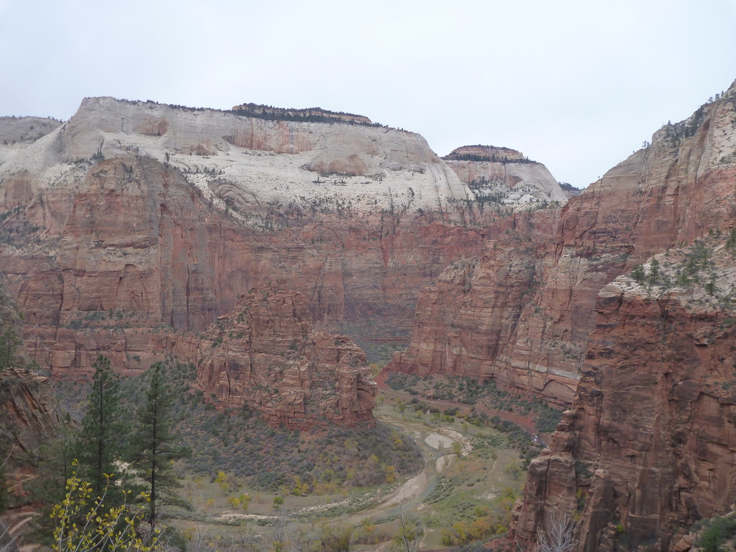
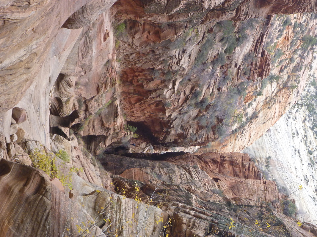
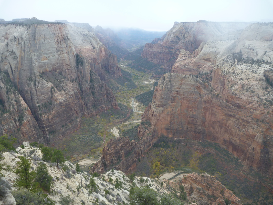
Backcountry trip #5: Zion NP (Nov. 4-5, 2013). 2 days, 22 mi, 3600 ft +/-. East Rim Trail.
A short backcountry hike up the East Rim. Views over Zion canyon are spectacular but the landscape in the high country is underwhelming.
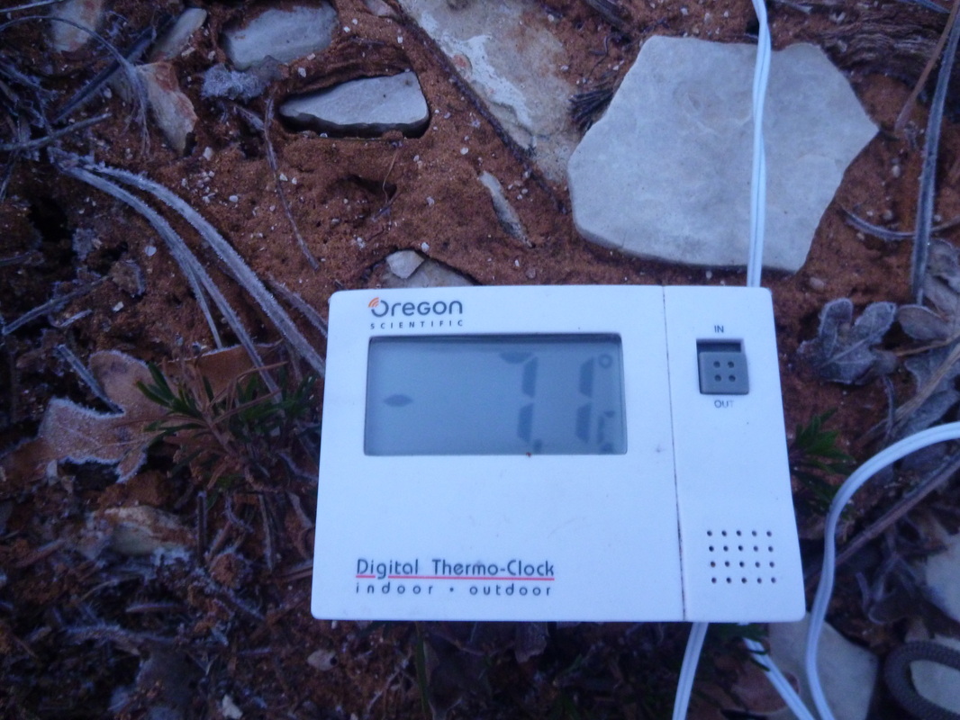
Weather was wet on Day 1 (frequent snow and rain showers) and pretty cold overall: temps in the upper 10s (-7°C) at the top of Cable Mountain at sunrise on Day 2! More generally in the 30's.
Almost no wildlife!
Start/End: Weeping Rock (4350 ft).
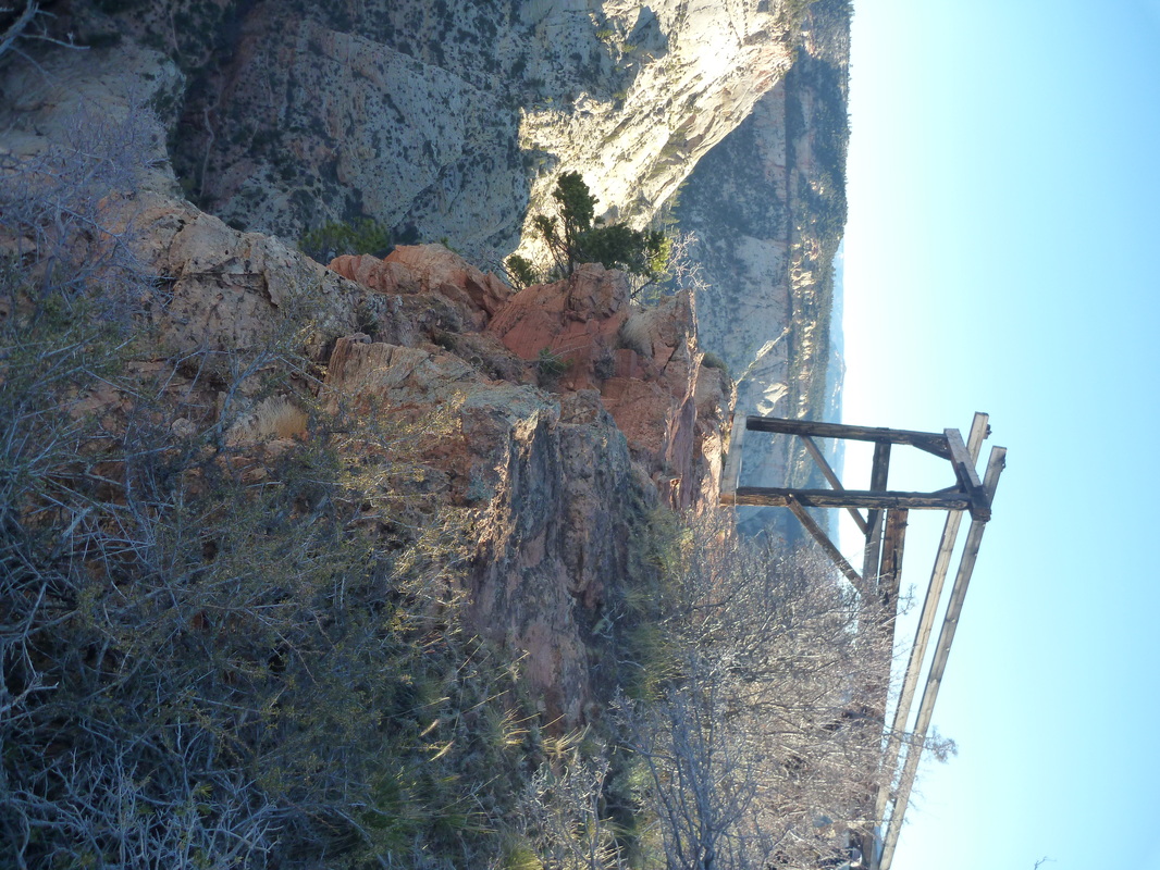
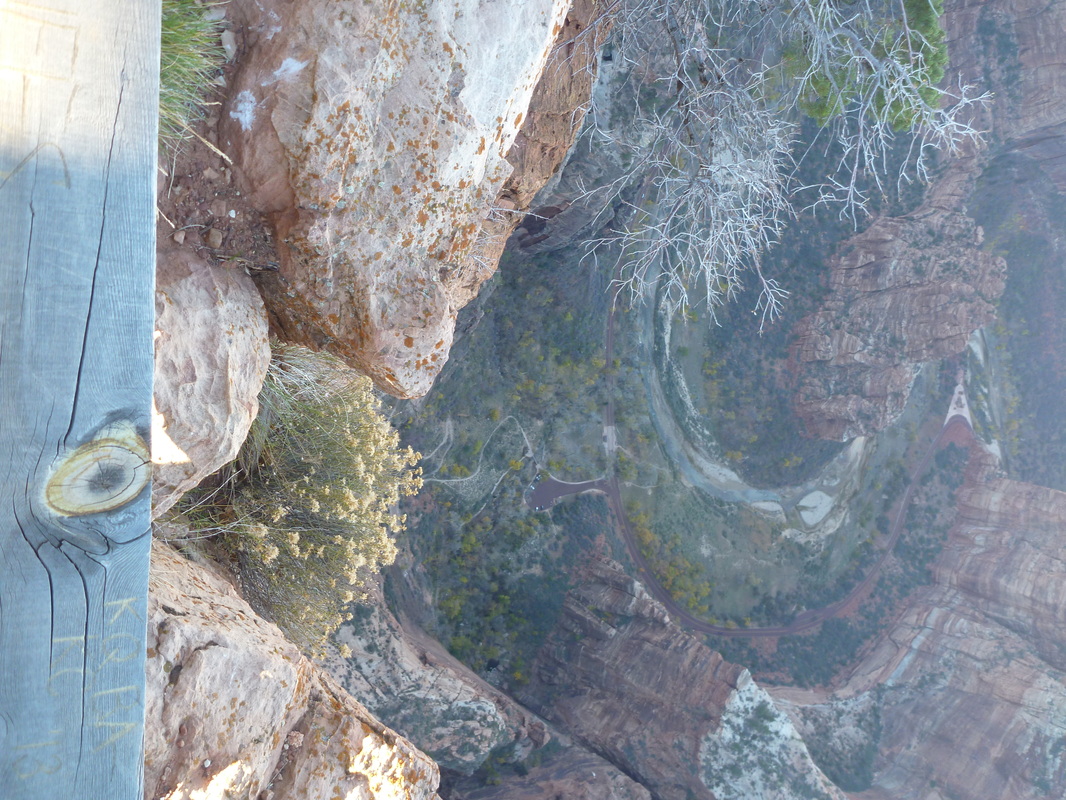
Day 1 (11am - 5.30pm): Weeping Rock - Observation Point (6500ft) - Cable Mountain (6900 ft). Energetic climb in very scenic Echo Canyon. Trail scenery only worth the trip! Terrific views over Zion Canyon at Observation Point. The climb up to Cable Mountain is a bit steep in parts until you reach gentle Cable Mountain Trail. Camped close to the summit of Cable Mountain, with great views over Echo Canyon. 11 mi, 3600 ft +, 1000 ft -.
Day 2 (7.15am - 1pm) : Cable Mountain - parking lot. We walked the short mile down to the old Cable installation and the overlook at the Rim. Great views! Then, long walk down. 11 mi, 2600 ft -.
A short backcountry hike up the East Rim. Views over Zion canyon are spectacular but the landscape in the high country is underwhelming.
Weather was wet on Day 1 (frequent snow and rain showers) and pretty cold overall: temps in the upper 10s (-7°C) at the top of Cable Mountain at sunrise on Day 2! More generally in the 30's.
Almost no wildlife!
Start/End: Weeping Rock (4350 ft).
Day 1 (11am - 5.30pm): Weeping Rock - Observation Point (6500ft) - Cable Mountain (6900 ft). Energetic climb in very scenic Echo Canyon. Trail scenery only worth the trip! Terrific views over Zion Canyon at Observation Point. The climb up to Cable Mountain is a bit steep in parts until you reach gentle Cable Mountain Trail. Camped close to the summit of Cable Mountain, with great views over Echo Canyon. 11 mi, 3600 ft +, 1000 ft -.
Day 2 (7.15am - 1pm) : Cable Mountain - parking lot. We walked the short mile down to the old Cable installation and the overlook at the Rim. Great views! Then, long walk down. 11 mi, 2600 ft -.
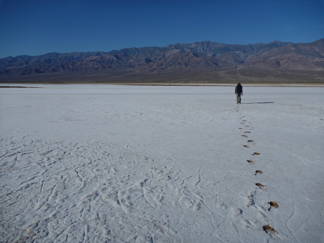
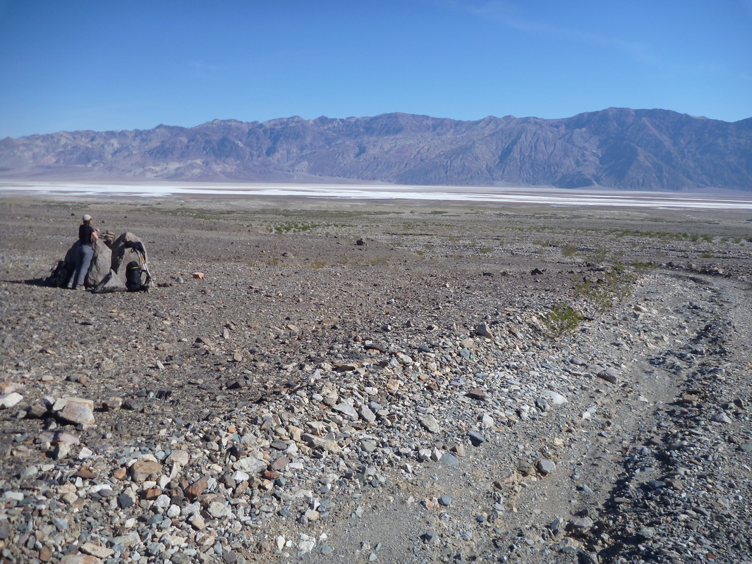
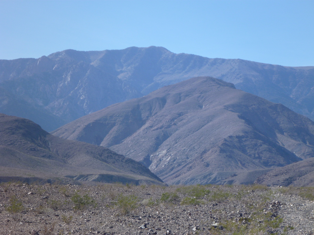
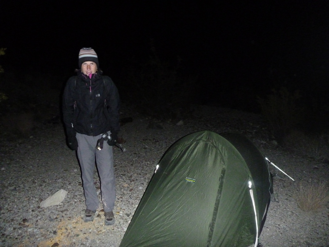
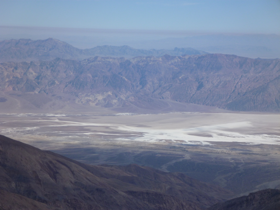
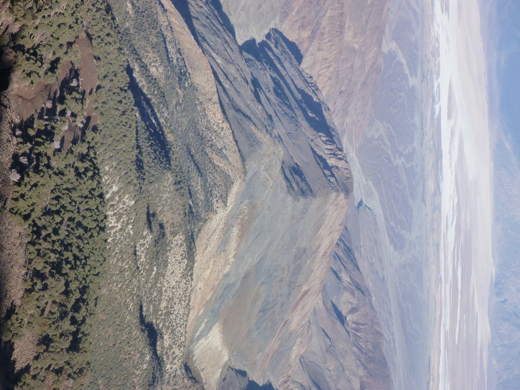
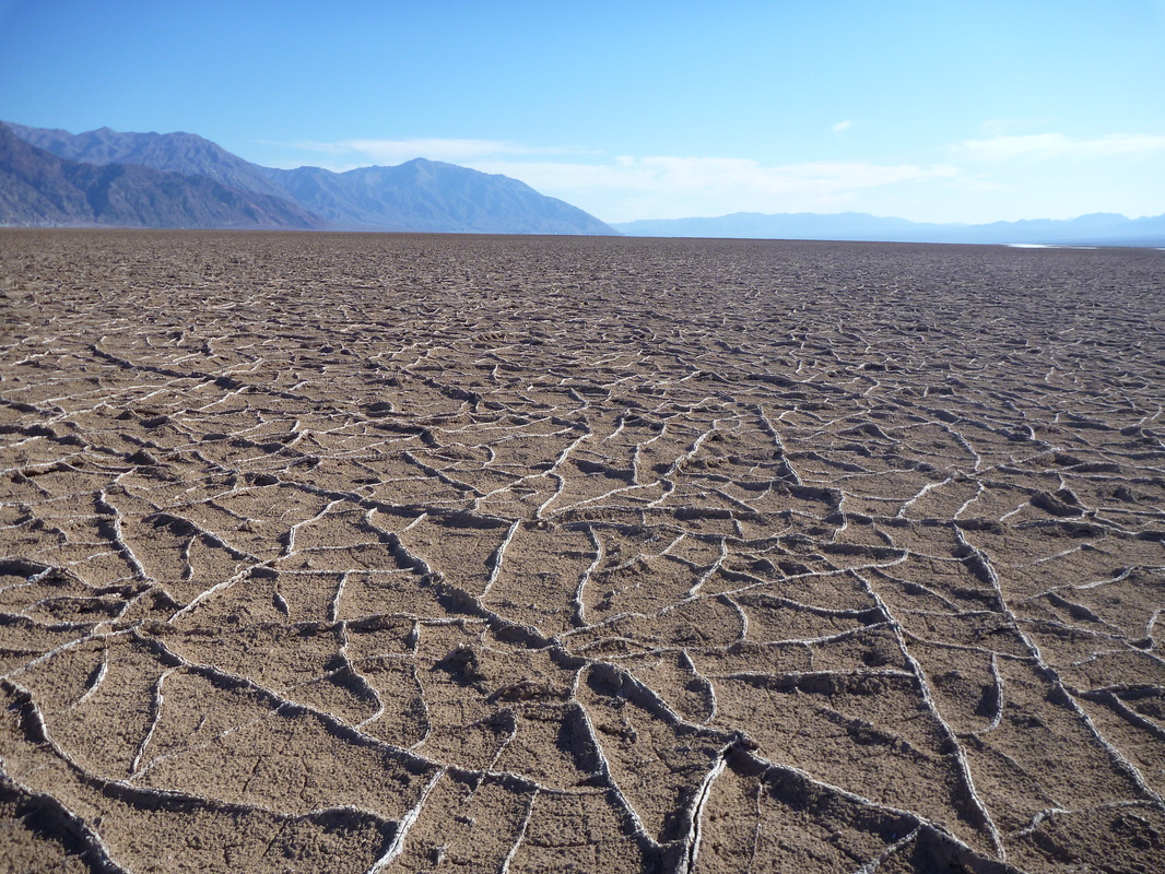
Backcountry trip #6: Death Valley NP (Nov. 08-10, 2013). 3 days, 43.5 mi, 11500 ft +/-. Badwater (-283 ft) - Telescope Peak (11049 ft) (and back!).
OK, now, we are talking about our last, most strenuous hike in the US... by far! After reading some reports on the internet, it seemed obvious that the challenge to climb Telescope Peak from the Valley would be a great way to end our hiking trip across Western US.
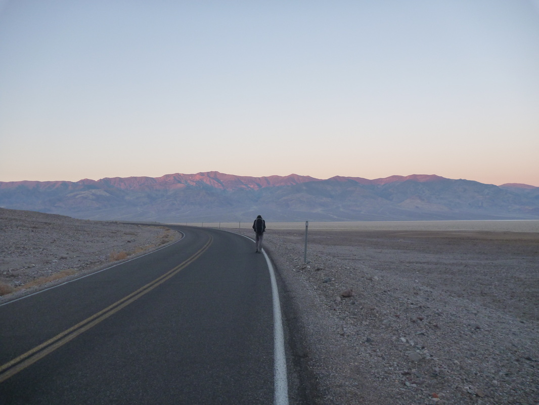
West Side Road was closed. We then had to start our hike from Badwater proper, on the other side of the Valley, which turned out to be a wonderful addition. The road to Mahogany Flat was closed. We have not seen anyone during three days!
Start/End: Badwater parking lot.
Generally speaking, we used a route that was very close to the one given here: http://images.summitpost.org/original/353252.gif . According to a book we found at the general store in Furnace Creek, another option is to climb the whole west/east ridge and not walk part of the South Fork Canyon.
So now, in detail:
DAY 1
- 06.10am. From Badwater parking lot, we walked 1/4 mi on the paved road to the south-west to avoid the slippery/wettest parts off the parking lot.
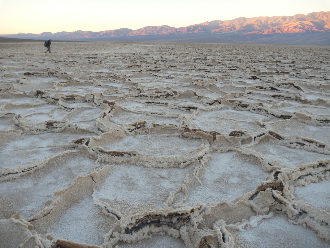
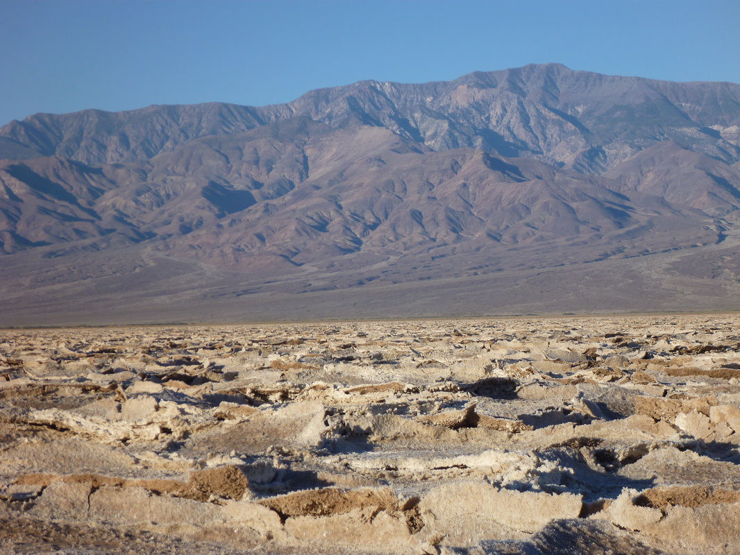
- 06.30am. Then, head due West across the Valley.
- 09.30am (6mi). We hit the road just south of Shortys Well. Then, climbed up towards the mouth of Hanaupah Canyon.
- 04.00pm (14 mi). Finally got to the trailhead. From there, there is no real trail, but we followed the bottom of the Canyon to the streams. Staying on the north bank of the dry river was perfectly fine. Almost no bushwacking.
- 04.45pm. (15mi), sunset. We camped just where the canyon divides in two, on the north side of the springs.
OK, now, we are talking about our last, most strenuous hike in the US... by far! After reading some reports on the internet, it seemed obvious that the challenge to climb Telescope Peak from the Valley would be a great way to end our hiking trip across Western US.
West Side Road was closed. We then had to start our hike from Badwater proper, on the other side of the Valley, which turned out to be a wonderful addition. The road to Mahogany Flat was closed. We have not seen anyone during three days!
Start/End: Badwater parking lot.
Generally speaking, we used a route that was very close to the one given here: http://images.summitpost.org/original/353252.gif . According to a book we found at the general store in Furnace Creek, another option is to climb the whole west/east ridge and not walk part of the South Fork Canyon.
So now, in detail:
DAY 1
- 06.10am. From Badwater parking lot, we walked 1/4 mi on the paved road to the south-west to avoid the slippery/wettest parts off the parking lot.
- 06.30am. Then, head due West across the Valley.
- 09.30am (6mi). We hit the road just south of Shortys Well. Then, climbed up towards the mouth of Hanaupah Canyon.
- 04.00pm (14 mi). Finally got to the trailhead. From there, there is no real trail, but we followed the bottom of the Canyon to the streams. Staying on the north bank of the dry river was perfectly fine. Almost no bushwacking.
- 04.45pm. (15mi), sunset. We camped just where the canyon divides in two, on the north side of the springs.
DAY 2
- 05.30am. We start to climb up the steep west/east ridge (northward, slightly to the west) that separates the Middle and South Forks. On the way up, we follow some tracks and a few cairns.
- 07.15am. We reach the west/east ridge. Now, it is a pretty obvious hike along this ridge. It is a bit frustrating to walk for miles without gaining much elevation. There are a lot of footprints you can follow in the open pine forest. In the unusual case it had rained just before, I doubt you could see anything. Do not expect any cairn or sign.
- 10am. We get to the serious part of the climb: a short walk 2500 ft up steep loose rocks and boulders to get to the main ridge. 2 steps up, 1 step down. If you are heavier than a feather, this part is by far the most strenuous. You have to exercise caution as a lot of rocks are rolling down as you climb up.
- 11.45am. We hit the beaten Mahogany Flat trail one mile from summit. It is now a nice gentle stroll up to the top (when compared to the previous part!).
- 12.45pm (6.7mi). We stand atop Telescope Peak!
Using the same route down, we got back to our camp by 06.45pm.

DAY 3: DAY 1 reversed .
Some comments:
* The season: timing seemed (almost) perfect. The Peak was snowless and temps in the Valley were fine (in the 70s).
The only issue with November is that you get sunlight from 05.30am (sunrise at 06am) till 05pm (sunset around 04.30pm) . On day 2, we had to finish our hike using our headlamps. Terrain was steep and full of rolling rocks. Navigation was tricky, and we relied on our GPS unit. It would have been MUCH better/safer/comfortable if we could have crammed this grueling day in less than 12 hours.
* Water: we carried 2.7 gallons per person for 3 days. It was exactly what we needed. The Hanaupah Spings were flowing but we did not want to depend on them.
* Scenery: it cannot get any better I guess. Death Valley is spectacular, this hike is superlative.
 RSS Feed
